John is a history detective who digs beneath the legends, folklore, and myths to learn what’s either been hidden from the common narrative or else lost to time, in hopes of enlarging the collective understanding of our culture and communities.
The Revere House, 512 Kentucky Street, 1959 (Sonoma County Library)
In 1962, a fire broke out on Kentucky Street between Kent and Galland streets, destroying one of the oldest landmark buildings in Petaluma.
Built in 1861 as a hotel called the What Cheer House—later renamed the Revere House—it originally sat at the southeast corner of Oak Street and Petaluma Boulevard North. In 1907, part of the building was moved to 512 Kentucky Street, where it became a private residence.
The hotel was built by George W. Cofer, who came to Sonoma County in 1852, having crossed the plains from Missouri in a wagon train. He initially settled on a farm west of Petaluma and married Nancy Ann Peters. In 1861, the couple moved into private quarters in their newly constructed What Cheer House.[1]
Stagecoach outside the What Cheer House, Main and Oak Streets, 1860s (Sonoma County Library)
Three stories high, the hotel had 50 rooms, a dining hall and bar, and an adjacent livery stable. For many years it was the largest hotel in town, offering a commanding view of Petaluma Valley and the Sonoma Mountain Range. The nightly room rate was 25 cents a night ($10 in today’s currency).[2]
Cofer borrowed the name from the popular What Cheer House in San Francisco. That city’s largest hotel, it initially opened 1852, admitting only male guests and banning liquor on the premises.[3]The hotel’s name came from an old English expression—“What cheer, friend?”— a friendly salutation commonly used during the Gold Rush.[4]
What Cheer House on Sacramento Street in San Francisco, 1850s (Library of Congress)
Cofer’s guests were primarily teamsters, farmers, and drovers bringing grains, produce, and livestock into town. The hotel’s livery stable featured a scale for weighing hay and grain. Across the street sat Petaluma’s early flour mills. A free shuttle transported guests to and from the steamboat ferry landing on the river. The hotel also served as a stagecoach depot for passengers venturing north to Santa Rosa or Sebastopol.[5]
In 1865, Cofer sold the hotel and departed for Honolulu. He later took his wife and children to Peru, where they allegedly became the first Americans to cross the Andes. The Cofers ultimately settled on a farm near Red Bluff. [6]
Ad for the Stockdale House, 1866 (Petlauma Weekly Argus)
The hotel’s new owner, Hugh Stockdale, came to Sonoma County from Pennsylvania in the early 1850s. Owner of a dry goods store in Bloomfield, he was an avid horse breeder, and helped to organize the first county fair held in Petaluma in 1867.[7]
Stockdale changed the name of the What Cheer House to the Stockdale House, and refurnished it to appeal to not only to farmers and teamsters but also to their families.[9] He lived with his own family in the private quarters Cofer created at the hotel. After two years, Stockdale leased the hotel to Reuben L. Gardner, one of California’s legendary hotel keepers, but continued to reside there with his family .[10]
Ad for Reuben L. Gardner’s Revere House, 1867 (Petlauma Weekly Argus)
A native of Rhode Island, Gardner had operated a series of hotels in California and Nevada, beginning with Sacramento’s Crescent City Hotel in 1850. He renamed Stockdale’s hotel The Revere House, most likely after Boston’s famous hotel of the same name. Within a couple years, Gardner moved on to a new hotel venture.[11]
The Stockdale family continued to reside at the hotel for the next 40 years, leasing its operation to a series of proprietors. Stockdale died there in 1890, followed by his wife Carrie 12 years later. In 1906, Stockdale’s children moved out and sold the building, but not the lot, to Charley Offutt, a local dairyman. [12]
Offutt first arrived in Petaluma in 1853 as a one-year-old infant traveling with his parents on a wagon train from Missouri.[13] His parents established 1,000-acre dairy ranch that stretched from Chileno Valley to Tomales Bay. Offutt took it over after their passing. In 1906, he decided to retire from dairy ranching and moved into town with his wife.[14]
Offutt’s main reason for buying the hotel building was to use its hand-hewn lumber in constructing a new house on a lot he purchased a block away. The lot extended from Petaluma Boulevard North to Kentucky Street. Subdividing the lot, Offutt used the lumber from the hotel’s first floor to build a Craftsman-style home for his family at 509 Petaluma Boulevard North (adjacent today to the former parking of North Bay Kitchen & Bath).[15]
Offutt House, built 1907 with lumber from the Revere House, 509 Petaluma Boulevard North (public domain)
He moved the top two stories of the Revere House to Kentucky Street, where he converted them into a single private residence he rented out. For brief periods, Offutt’s daughter Jennie, a graduate of the San Francisco Conservatory of Music, lived there with her husband Arlington W. Stephenson, a music professor. Touring performers during the Vaudeville era, the couple eventually moved to San Francisco.[16]
Following Offutt’s death in 1935, Jennie Offutt Stephenson moved back into the old Revere House, apparently to be close to her elderly mother. Having recently separated from her husband, she began running a series of local night clubs—the Silver Dollar Club, the Rainbow Inn, and the Depot Hotel in Valley Ford (today’s Dinucci’s Restaurant)—with nightly jazz bands and dancing.[17]
Former Revere House as private residence downstairs and upstairs apartments, 512 Kentucky Street, 1953 (Sonoma County Library)
During World War II, Stephenson converted the top floor of the old Revere House into four rental apartments.[18]On the evening of February 6, 1962, a smoldering cigarette left in one of the rented rooms set off a fire that severely damaged the old building.[19]
Fire at the Revere House, 1962 (Sonoma County Library)
Stephenson tore down the building and in its place constructed the four-unit apartment complex that resides on the site today. The only remanent of the landmark Revere House is the lumber in the old Offutt house at 509 Petaluma Boulevard North.
A version of this story appeared in the Petaluma Argus-Courier, October 9, 2026
FOOTNOTES:
[1] “Married,” Sonoma County Journal, April 10, 1857; Ad for the What Cheer House, Petaluma Argus, September 20, 1861; “Death of G.W. Cofer,” Daily Red Bluff News, August 6, 1895.
[2] Ad for the What Cheer House, Petaluma Argus, September 20, 1861; “Jottings,” Petaluma Courier, January 29, 1879: best hotel view in town.
[3] “Library of Congress Images Show S.F. As It Was Before 1870,” SF Gate.com, July 20, 2020.
[4] “The What Cheer House,” Stagenine.com, https://www.stagenine.com/pages/the-what-cheer-house
[5] Ad for What Cheer House, Petaluma Argus, September 20, 1861; Ad for Revere House, Petaluma Argus, April 4, 1867.
[6] For Sale ad for What Cheer House, Petaluma Argus, June 30, 1864; Ad for Stockdale House, Petaluma Argus, July 20, 1865; Ad for Stockdale House listing Stockdale as proprietor, Petaluma Argus, November 9, 1865; “Passengers,” Daily Alta California, March 25, 1865; “Passengers,” Daily Alta California, March 25, 1865.
[7] Ad for Miller & Stockdale Dry Goods Store, Sonoma County Journal, June 1, 1860; “County Fair, Petaluma Argus, April 11, 1867; “Dead,” Petaluma Courier, November 12, 1890.
[9] Ad for Stockdale House, Petaluma Argus, November 16, 1865.
[10] “Good Change All Around,” Petaluma Argus, March 14, 1867; First ad for the Revere House, Petaluma Argus, March 21, 1867; “Death of R.L. Gardner,” Oakland Tribune, August 8, 1877.
[11] “The Revere House,” https://en.wikipedia.org/wiki/Revere_House.
[12] “Dead,” Petaluma Courier, November 12, 1890; “Death Calls Mrs. Stockdale,” Petaluma Argus, May 10, 1902; “Briefs,” Petaluma Courier, September 25, 1903: rooms still being rented at Revere House; “Briefs,” Petaluma Courier, June 4, 1906: Stockdale heirs move out of hotel.
[14] “Pioneer Ranch Owner, 83, Passes,” Petaluma Argus-Courier, September 28, 1935; “Jennie Stephenson Dies in Petaluma,” Santa Rosa Press Democrat, December 25, 1977.
[15] “Historical Unity Meets Next Week,” Petaluma Argus-Courier, September 23, 1959.
[16] “Life Ends for Mrs. Isable Farrel,” Petaluma Argus-Courier, April 9, 1945; Jennie Stephenson Dies in Petaluma,” Santa Rosa Press Democrat, December 25, 1977.
[17] Jennie Stephenson Dies in Petaluma,” Santa Rosa Press Democrat, December 25, 1977.
[18] “Silver Dollar Reopens August 29,” Petaluma Argus-Courier, August 24, 1936; “Rainbow Inn to Be reopened Saturday,” Santa Rosa Republican, June 24, 1937; “Valley Ford Hotel is Leased,” Petaluma Argus-Courier, March 4, 1938; “Condition of Mrs. Offutt Critical,” Petaluma Argus-Courier, October 7, 1942; “Obituaries: Jennie B. Stephenson,” Petaluma Argus-Courier, December 24 1977.
Steamboats docked at the San Francisco wharf, circa 1850s (photo courtesy of the Golden Gate NRA, Park Archives)
Petaluma was never just about chickens and cows. From day one, the city has been a transportation hub for goods and people. Which was why, legend has it, the town faced its first existential crisis in the summer of 1852.
Established the previous winter, Petaluma found itself unexpectedly confronted by a rival town calling itself Petaluma City. Located just a couple miles downstream on the Petaluma Creek—as the river was then known—the new town allegedly sought to replace Petaluma as Sonoma County’s main shipping port.[1]
Back then, the waterways were the highways. Petaluma Creek was sprinkled with the sails of flat-bottomed schooners hauling game meat, potatoes, and hay from Petaluma to San Francisco.
Flat-bottomed scow schooner with hay on the Petaluma Creek (Petaluma Historical Library & Museum)
But paddlewheel steamboats—the Bay Area’s main means of transportation—were nowhere to be seen. Robert A. Thompson, author of Sonoma County’s first written history, A Historical and Descriptive Sketch of Sonoma County, claimed deeper water vessels were afraid of running aground, given the creek was actually a tidal estuary that rose and fell twice a day with the ocean tides.[2]
According to Thompson, Petaluma City’s strategy for putting Petaluma out of existence turned on luring steamboats up the creek. In the fall of 1852, they persuaded the captain of a steamer called the Red Jacket to pilot his boat on high tide up the creek to their new landing.[3]As the remaining three miles of the waterway to Petaluma were then a zigzagging maze of braided bends, seemingly impossible for a steamboat to navigate, Petaluma was effectively left up the creek without a paddleboat.
1860 U.S. Coast Survey map shows oxbow bends in Petaluma Creek from Petaluma City, aka, New Town, at blue star, to Petaluma, red star (Petaluma Historical Library & Museum)
But Petalumans refused to concede defeat. They managed to convince the Red Jacket’s captain to navigate his boat through the serpentine bends to the Petaluma docks, thus putting an end to the existential steamboat rumble and ultimately to Petaluma City itself. [4]
Robert A. Thompson and his 1877 history of Sonoma County (photo Tuomey’s 1926 History of Sonoma County)
As origin stories go, Thompson’s sounds like a tall tale told over drinks in a local saloon. Little of it holds water. While the creek undoubtedly posed a navigational challenge for steamboats in 1852, the reason they weren’t plying its waters was more likely because, aside from meat and potatoes, Petaluma had so little to offer. But times were changing.
THE FOUNDING OF PETALUMA
In the summer of 1851, a disappointed, 50-year-old gold miner from Missouri named George H. Keller rode into a rugged camp along the Petaluma Creek. Set on a former Miwok trading village called Lekituit, the camp consisted of a few rustic cabins occupied by game hunters and a warehouse for storing potatoes, Sonoma County’s first boom crop, to ship down to San Francisco.[5]
That fall, newspapers in San Francisco and Nevada City began running ads of farmland for sale in the Petaluma Valley.[6]Gold miners—only a fraction of whom made any money—began streaming into the camp, looking to stake their claim in California’s next gold rush: agriculture.[7] To accommodate them, Keller built a makeshift general store, hostel, and dining house beside the creek.[8]
Ad in the Daily Alta California newspaper, November 18, 1851
At the time, the Petaluma Valley, along with another 10 million acres in California, was subdivided into large Mexican land grants. Thanks to the 1848 Treaty of Guadalupe Hildago that ended the Mexican-American War, they remained in the hands of their Mexican owners. But not for long. By American legal standards, many of California’s land grants were sketchy or saddled with disputed claims. That included the 13,316-acre Rancho Arroyo de San Antonio the Petaluma camp sat upon, which had two parties claiming ownership.[9]
To clean up the legal morass, in 1851 Congress appointed a three-man Land Commission to review California’s 813 land grants. The commission placed the legal burden of proving ownership upon the Mexican grant holders. Many of them, unable to pay the exorbitant legal fees, were forced to sell to American speculators, who then subdivided the land grants into farms and ranches for sale.[10]
Like everything during the Gold Rush, investing in real estate was a gamble. Buyers could either purchase a parcel in hopes the Land Commission would ultimately approve the speculator’s land grant claim—a process that could take many years—or they could illegally squat on the parcel in hopes the commission would reject the speculator’s claim. In such cases, the land grant would be placed in the public domain, allowing the squatter to make a homesteader’s claim to their parcel under the Preemption Act of 1841.[11]
Many decided to roll the dice as squatters. Banding together, they organized settlers’ associations, including at the Petaluma camp.[12] It was there, in December 1851, that a group formed the Settlers’ Association of the Rancho Arroyo de San Antonio as a last resort after efforts to contact the rancho’s two rival owners were met with silence. They elected Major Henry P. Heintzelman, a 32-year-old Pennsylvanian who fought in the Mexican-American War.[13]
The association’s stated purpose was to monitor the Land Commission’s legal review process, but their real intention was to support George Keller in making a squatter’s claim to a 158-acre parcel upon which to establish the town of Petaluma.
In the fall of 1851, Keller hired a surveyor named John A. Brewster, who first came to California in 1846 as a cartographer with Captain John C. Frémont, to map out the town on 40 acres of his claim. He then began selling lots at his general store on Washington Street beside the creek.[14]His first recorded sale was on January 3, 1852, to David Flogdell, who purchased a lot at the foot of today’s Western Avenue, where he and Thomas Baylis built the Pioneer Hotel.[15]
John A. Brewster, surveyor (courtesy of the California State Lands Commission)
Keller’s sales were all filed by the Sonoma County recorder’s office, which apparently shared his skepticism that the Land Commission would ever determine a legal owner for the Rancho Arroyo de San Antonio. It helped that Brewster was the county recorder’s deputy clerk, and that Keller’s real estate attorney, a 46-year-old miner from Tennessee named Micajah G. Lewis, was appointed Petaluma’s first justice of the peace.[16]
To make sure buyers understood the risk involved, Keller promised in in his property deeds to defend buyers against lawful claims to their property, “except the confirmed titles of any Mexican Grant of the Government of the United States.”[17]
THE FOUNDING OF PETALUMA CITY
A few months after Keller began selling lots, his lawyer Lewis teamed up with Heintzelman, president of the local Settlers’ Association, to create Petaluma City. As a third partner, they brought in Colonel James B. Huie, 53-year-old businessman from Kentucky who operated an auction house in San Francisco.
Ad for San Francisco auction house of James B. Huie & Co., Daily Alta California newspaper, July 22, 1850
The three men then entered into a deal with Mariano G. Vallejo to develop Petaluma City on 600 acres of Vallejo’s 66,000-acre Petaluma Rancho that extended from the eastern bank of the Petaluma Creek to Sonoma.[18]
Land grants around Petaluma and Petaluma City (“New Town”), including Vallejo’s Petaluma Rancho and the Rancho Arroyo de San Antonio, listed here as the Miranda Rancho (map Leander Ransom, Bancroft Library)
They centered the new town around Vallejo’s Landing on the creek at the end of Casa Grande Road.[19] Site of today’s Rocky Dog Park, Vallejo used the landing during his operation of the Petaluma Adobe to ship hides and tallow down the creek to San Francisco for export to Europe.[20]
Left, the original street grid of Petaluma City, 1852 (Sonoma County Deed Records); right, colored outline of the original street grid imposed on a current map of the area, with the original bends in the creek in blue (courtesy of Terry Park, Petaluma Historical Library & Museum)
Cash-strapped after the Mexican-American War decimated his cattle empire, Vallejo took half interest in Petaluma City’s development—the odd numbered lots—apparently hoping he had found himself a new cash cow.[21]
Petaluma City (aka New Town) circled in red on Vallejo’s subdivisions of his Petaluma Rancho land grant, Rowe & Rowe map, 1850 (Petaluma Historical Library & Museum)
Within a month of filing the development with the county, Lewis sold his interest to Huie, retaining a handful of lots as a passive investor.[22]Huie and Heintzelman then opened a realty office at the southeast corner of Washington and Main streets, across from Keller’s store, and began selling lots to Petaluma City. Locals quickly nicknamed the development New Town.[23]
Contrary to Thompson’s account, it doesn’t appear Petaluma City’s developers were looking to usurp Petaluma as the creek’s head of navigation. There were no signs of bad blood between them and Keller, in fact, Lewis continued to serve as Keller’s real estate attorney.[24] It was more like a poker game with the Land Commission dealing the cards. Everyone knew Keller held a weak hand with his squatter’s claim, and Petaluma City’s developers were merely hedging their bets.[25]
Thompson’s story of the steamboat rumble is also dubious. He claims Huie convinced the captain of the Red Jacket (whom he misidentified as Captain Van Pelt) to pilot his boat up the creek to Petaluma City.[26] Huie—who later took credit for introducing steamboats to the creek—more likely convinced the Red Jacket’s owner, Thomas Hunt of the Union Line Company, that the route had sufficient freight and passenger demand to make it financially viable.[27]
Hunt purchased the Red Jacket specifically for Petaluma Creek. The steamer was previously owned by Charles Minturn—aka the “Ferryboat King”—who ran it between San Francisco and Oakland. In September 1852, Hunt bought the boat from Minturn and directed Captain L.B. Edwards to begin making runs from San Francisco to Petaluma three times a week. There were no scheduled stops at Petaluma City, which was still in early development. [28]
The creek was, and remains, a challenging waterway. It descends from an altitude of 300 feet at its headwaters near Denman Flats to near sea level by the time it reaches Petaluma. There it converges with a tidal estuary extending 12 miles to the San Pablo Bay. Instead of flowing, the estuary rises and falls twice a day with the ocean tides. Sediment flowing down the freshwater portion of the creek—especially during rainy winters—settles as silt in the estuary. While that undoubtedly posed challenges to steamboats, they were manageable as long as their captains paddled the creek at high tide.[28a]
The Red Jacket’s run lasted only six weeks. After returning from a trip to Petaluma on November 2, 1852, it was severely damaged in a storm at the San Francisco wharf.[29]Steamboats would not return to the Petaluma Creek until the spring of 1853, when Huie and Heintzelman bought one of their own, the Soic, which they renamed the Reindeer. They began running the Reindeer three days a week from San Francisco to both Petaluma and Petaluma City, which had developed into a wharf, a couple of warehouses, and a handful of dwellings.[30]
Ad for Reindeer steamboat, Daily Alta California newspaper, March 4, 1854
In the fall of 1853, Minturn began running one of his steamboats, the E. Corning, between San Francisco and Petaluma three times a week.[31]It was his way of marking territory.
Charles Minturn standing before his steamboat the E. Corning, San Francisco, California, about 1852 (Sonoma County Library0
A few months later, he and other major steamboat operators formed the California Steam Navigation Company, assigning members monopolies to various waterways in order to impose higher fees by reducing competition. Minturn was awarded the steamboat monopoly on the Petaluma Creek.[32]He promptly added a second steamboat to the creek, the old Red Jacket, which he had repurchased, refitted, and renamed the Kate Hayes.[33]
THE DOWNTURN
Then California’s first recession hit, the result of overspeculation, a market glut of goods, and a real estate crash. Around that time, Sonoma County’s potato boom went bust, the victim of overproduction and soil depletion.[34]Petaluma, whose population had grown to more than 400 in 1854, began to stagnate, as did, presumably, Petaluma City.[35]
During the recession, founders of both Petaluma and Petaluma City began to depart for greener pastures. Keller was to first to go. In the fall of 1853, he returned to the Midwest, where he joined with a group of developers in co-founding the city of Leavenworth, Kansas. Before leaving town, he granted his lawyer Lewis power of attorney in all future property sales in Petaluma.[36]
Lewis himself ran into financial trouble during the recession, defaulting on a handful of property investments. He left town in 1854, eventually settling in Calaveras County, where he was elected county supervisor.[37]
Heintzelman and Huie continued to operate the Reindeer steamboat until November 1854 when, undercut by Minturn’s new monopoly, the boat was repossessed and sold at auction.[38] The next month, Heintzelman was elected to the state senate, representing Sonoma, Marin, and Mendocino counties. After his term ended in 1856, he departed for Crescent City, where he was appointed government agent for the Klamath Indian Reservation.[39] That same year, Brewster was elected Surveyor General of California and left for Sacramento.[40]
Huie left town shortly thereafter, eventually returning to Kentucky.[41] He passed the development of Petaluma City over to his two sons, J. Thompson Huie, a Petaluma druggist, and Dr. George W. Huie, a Petaluma physician. By then it had failed to develop into much more than a shipping port for farmers and ranchers on the east side of the creek.[42]
In 1855, the Land Commission conferred ownership of the Rancho Arroyo de San Antonio to James F. Stuart, after he cut a deal with Thomas B. Valentine to withdraw his competing claim.
Illustration of James F. Stuart, 1893 (San Francisco Call newspaper)
More than 200 Petaluma landowners forked out $70,000 ($2 million in today’s currency) to repurchase their properties from him. Stuart split the proceeds with Valentine, who, feeling shortchanged, later challenged Stuart’s ownership in court, setting off a complicated legal battle that wasn’t fully resolved until 1874.[43]
1855 illustrated map of Petaluma by L.W. Worth, with an illustration of James F. Stuart’s real estate office at the bottom (Sonoma County Library)
Meanwhile, Petaluma’s economy began to rebound thanks to the Crimean War which cut off Russian wheat exports to Australia and New Zealand, forcing those countries to turn to California.[44] By 1857, the California wheat boom had turned Petaluma into a bustling port town with a population of 1,338. A year later, it incorporated as a city.[45]
But the wheat boom posed a new existential threat to Petaluma. Increased runoff from the farms began to fill the Petaluma Creek with silt, especially at the braided bends near town, making it difficult for steamboats to navigate up into Petaluma.
In 1856, John Rudesill opened a new landing a mile south of Petaluma City on the west bank of the creek, which came to be known as Haystack Landing (today Dutra Material’s asphalt plant). Steamboat passengers disembarked there for stages into town, while freight was offload onto smaller, flat-bottom boats known as “mud stages” able to navigate the shallow waters.[46]
Elliot R. Moffet (Joblin Globe newspaper, 1923)
In 1859, the new City of Petaluma commissioned Elliot R. Moffet, a local businessman and owner of the Rambler steamboat, to cut through two of the largest bends in the creek, including the one leading to the Petaluma City landing.[47] Moffet made the cuts, but not to the satisfaction of the city, which refused to pay him. Saddled with debt, Moffet sold the Rambler and fled town, eventually returning to his home state of Iowa, where he co-founded the town of Joplin, serving as its first mayor.[48]
Illustration of Elliott R. Moffet’s steamboat the Rambler, navigating the Petlauma Creek in the 1850s (Petaluma Historical Library & Museum)
Moffet’s cut across the bend leading to Petaluma City meant that schooners and steamboats traveling to and from Petaluma now bypassed the Petaluma City landing. That was the final nail in the coffin for New Town. In the early 1860s, Huie’s sons sold off the remaining lots for farmland, and Petaluma City, aka New Town, became history.[49]
1860 U.S. Coast Survey map of Petaluma Creek featuring Rudesill’s Landing (aka Haystack Landing) and Newtown (aka Petaluma City), along with cuts made in the first two oxbow bends in the creek by Elliot Moffet in 1859 (Petaluma Historical Library & Museum)
In 1862, Charles Minturn undertook a new dredging of the creek from Haystack Landing to a point about a mile north called Italian Garden, across from Petaluma City’s landing. In an unintentional but fitting manner, he retired the former Red Jacket steamboat, now known as the Kate Hayes, at the site to serve as landing and freight dock. He then installed a horse-drawn rail line from Italian Garden to Petaluma.[50]
In 1866, after the creek around Italian Garden began to fill again with silt, Minturn extended his rail line to Haystack Landing. The Red Jacket was left to slowly crumble over the years into the mud, across from where it made its first run to Petaluma City in the steamboat rumble of 1852.[51]
******
Special thanks to Terry Park of the Petaluma Historical Library & Museum for his research assistance.
FOOTNOTES:
[1] Robert A. Thompson, A Historical and Descriptive Sketch of Sonoma County (Philadelphia: L.H. Everts & Co., 1877), pps. 55-56.
[5] Thompson, pps. 54-55; J.P. Munro-Fraser, History of Sonoma County (San Francisco: Alley, Bowen & Co., 1880), pgs. 131, 259; “From California,” Letter from James B. Huie, Louisville Courier-Journal, December 24, 1849.
[6] “Farm for Sale,” Daily Alta California, May 17, 1849; “Farms for Sale” ad, Daily Alta California, October 19, 1851; “Farms for Sale” ad, The Nevada Journal, November 6, 1851; “Auction Sales by Henry Fitch & Co.,” Daily Alta California, July 11, 1852.
[7] Kevin Starr, Richard Orsi, eds., Rooted in Barbarous Soil: People, Culture, and Community in Gold Rush California (Berkeley and Los Angeles: University of California Press. 2000), pps. 243-248, 278-280; Kevin Starr, California: A History (New York: Modern Library, 2005), pps. 110-111.
[9] David Hornbeck, “The Patenting of California’s Private Land Claims, 1851-1885,” Geographical Review, Vol. 69, No. 4 (October., 1979), pgs. 437-438, 443.
[10]Paul W. Gates, 1971, The California Land Act of 1851, California Historical Society, Vol. 50, No. 4 (Dec., 1971), pp. 395–430.
[11] Donald J. Pisani, “Squatter Law in California, 1850-1858,” Western Historical Quarterly, Autumn, 1994, Vol. 25, No. 3, pps. 291-292; Paul W. Gates, The California Land Act of 1851, California Historical Society, Vol. 50, No. 4 (Dec., 1971), pp. 395–430; “The Preemption Act of 1841,” 27th Congress, Ch. 16, 5 Stat. 453 (1841), accessed from www.minnesotalegalhistoryproject.org; Note: the Preemption Act of 1841 gave settlers the right to purchase 160 acres in the public domain, assuming they squatted on the land for at least 14 months, or made agricultural improvements to it for five years.
[12] “Settlers’ Association,” Daily Alta California, July 27, 1850; “Mexican War letter describing the Battle of the Sacramento, 1847,” California State Library, California History Room, https://oac.cdlib.org/findaid/001112803
[13] “General Notices,” Daily Alta California, December 18, 1851; Munro-Fraser, p. 259.
[14] “Pioneer Gone,” Sacramento Union, January 8, 1889; Adair Heig, History of Petaluma (Petaluma, CA: Scottwall Associates, 1982), p. 29; Munro-Fraser, pps. 259-260; Note: In 1855, the Land Commission decreed James Stuart the rightful owner of the Laguna de San Antonio land grant Petaluma sat upon, after which land owners were forced to repurchase their property from him.
[15] Sonoma County Deeds, Liber A, 1843-1853, Page 579 (original page 5), image 720, January 3, 1852; Munro-Fraser, p. 260.
[16] “Historical: Petaluma Birth and Growth,” Petaluma Courier, October 19, 1892; “Capt. Micajah Green Lewis, USA (1803 – 1893),” Geni.com, https://www.geni.com/people/Capt-Micajah-Lewis-USA/6000000121302494821; “Election Notice,” Daily Alta California, September 5, 1855; “Pioneer Gone,” Sacramento Union, January 8, 1889. Note: Brewster was elected on the People’s Party ticket, which advocated for settlers’ rights. He served one term of State Surveyor from 1856 to 1858.
[17] Sonoma County Deeds, Liber A, 1843-1853, Page 579 (original page 5), image 720, January 3, 1852.
[18] “Died in Kentucky,” Petaluma Argus, February 27, 1880; “Law Report,” Daily Alta California, April 25, 1855.
[19] Ed Mannion, “Casa Grande Road Served as Newtown,” Petaluma Argus-Courier, April 20, 1957.
[20] Stephen Silliman, Lost Laborers in Colonial California: Native Americans and the Archaeology of Rancho Petaluma (University of Arizona Press, 2004), p. 13; Allan Rosenus, General M.G. Vallejo and the Advent of the Americans (Albuquerque: University of New Mexico Press, 1995), p. 212-13.
[21] Ed Mannion, “Casa Grande Road Served as Newtown,” Petaluma Argus-Courier, April 20, 1957; Liber A Deeds, Sonoma County, Page 710-711 (original page 208-209) Sonoma County Deeds: deed sale by Mariano G. Vallejo of Sonoma to M.G. Lewis and Henry P. Heintzelman of Petaluma of “undivided half of the town site of Petaluma” as laid down in map by C.W. Rowe. Lewis and Heintzelman to hold even numbered lots, and Vallejo odd numbered lots. Lewis and Heintzelman also deposit an undivided interest in said town to James B. Huie. Signed by Vallejo, Lewis, Heintzelman, and Huie.
[22] Deeds, Liber M, Sonoma County, Pages 171-173 (original page 197-198) Sonoma County Deeds: On July 9, 1852, M.G. Lewis sells James B. Huie for $1,000 his interest in 600 acres known as the City of Petaluma mapped out by Wesley Rowe, being a piece of the parcel conveyed by Mariano G. Vallejo to Lewis and H. P. Heintzelman in deed on June 12, 1852. Lewis reserves for himself 7 lots of 80×100 feet each; Note: Lewis also made an unsuccessful run for the state senate in 1852 (“From the Interior: Sonoma,” Sacramento Daily Union, October 4, 1852; “Election Returns—Sonoma County,” Sacramento Union, November 27, 1852).
[23] Deeds, Liber M, 1852-1855, Sonoma County, Pg. 3, image 230: September 20, 1852, ownership of lots 10 and 12, which on the 1852 Rowe map are beside the creek, in what appears to be marsh land: James B. Huie and Henry P. Heintzelman, joint owners of lots numbered 10 and 12 in Petaluma City, in consideration for one dollar each paid to the other, Lot 10 shall be divided into lots 80 feet, each fronting Front Street and running to the Petaluma Creek. Huie shall have the corner lot situated at Main & Front streets, the adjacent lot granted to Henry P. Heintzelman, and each remaining alternative lot in subdivision is granted to the two parties. The remaining part of Lot 12 running back to Petaluma Creek shall remain for the use of a ferry, owned by James B. Huie, the remaining part of Lot 12 owned by Heintzelman; Munro-Fraser, p. 260: location of Hertzelmann’s office.
[24] Deeds, Liber M, 1852-1855, Sonoma County, Pg. 267, image 366: On August 1, 1852, M.G. Lewis, serving as attorney on behalf of George H. Keller and “signing in fact” for Keller, for the sum of $150 sold lots 17 and 18 in Petaluma to Samuel Terrill (a fellow Justice of the Peace); Deeds, Liber M, 1852-1855, Sonoma County, Pg. 207, image 335: On July 24, 1853, M.G. Lewis, serving as attorney on behalf of George H. Keller and “signing in fact” for Keller, for the sum of $80, sold three lots in Petaluma to James Delaney.
[25] “Land Commission: Claims Filed Since Last Report,” Sacramento Daily Union, June 3, 1852.
[27] Ad for sailing yacht Gen. Geo. Cadwallader, Daily Alta California, May 18, 1850: Huie was engaged in the ferry business in San Francisco; “Died in Kentucky,” Petaluma Argus, February 27, 1880.
[28a] “Petaluma River Watershed,” City of Petaluma.com, https://cityofpetaluma.org/petaluma-river-watershed/; “City of Petaluma,” My Topo.com, https://geo.mytopo.com/feature/california/sonoma/civil/2411407/city-of-petaluma/; “Petaluma Valley Historical Hydrology and Ecology Study,” San Francisco Estuary Institute-Aquatic Science Center (SFEI), 2018, pgs. 38, 45-47. https://www.sfei.org/sites/default/files/biblio_files/Petaluma%20Historical%20Ecology%20med%20res.pdf
[28] Ad for Red Jacket, Daily Alta California, August 14, 1852; “Notice,” Daily Alta California, September 14, 1852; Ads for Red Jacket, Daily California Alta, September 24, 25, 26, 27, 30 1852, October 1, 1862; “Died in Kentucky,” Petaluma Argus, February 27, 1880: Huie’s obituary gives him credit for running the first steamer up the Petaluma Creek; Heig, p. 71.
[29] “The Gale Yesterday—Accidents in the Harbor,” Daily Alta California, November 4, 1852.
[30] Ad “For Petaluma,” Daily Alta California, March 2, 1853; “Notice, Daily Alta California, May 27, 1853; Ad for Reindeer Steamer for Petaluma, Daily Alta California, October 13, 1853; “From the Interior: Sonoma,” Sacramento Daily Union, July 28, 1853.
[31] First Ad for steamer E. Corning to Petaluma, Daily Alta California, October 27, 1853.
[32] Wilbur Hoffman, “When Steamers Sailed the Feather,” Sutter County Historical Society News Bulletin, Vol. XVIII, April 1979; Jerry McMullen, Paddle Wheel Days in California (Stanford University Press, 1944), pp. 17-19.
[33] Minturn ad for newly refitted Kate Hayes for Vallejo and Napa route, Daily Alta California, January 10, 1853; Ad for Kate Hayes for Petaluma, Daily Alta California, March 31, 1854; “Historical: Petaluma’s Birth and Growth,” Petaluma Courier, October 19, 1892.
[35] Thompson, p. 56. Note: Thompson provides the population figure, but avoids any mention of the recession, instead promoting a tale of rising prosperity.
[36] Henry Miles Moore, “Sketches of the Early Settlement of the City and County of Leavenworth,” Western Life (Leavenworth, KS), August 3, 1900; Deeds, Liber A, 1852-1855, Sonoma County, Pg. 833 (original page 93), image 842: on October 26, 1853, Keller grants Lewis power of attorney in all his real estate transactions in Petaluma. Note: it appears that Keller’s son, Garret V. Keller, who remained in Petaluma for a few years, also handled some property sales after his father’s departure.
[37] “Election Returns,” San Andreas Independent, September 4, 1858; “Postal Affairs,” Sacramento Union, August 18, 1884; Deeds, Liber M, 1852-1855, Sonoma County, Pg. 149, image 304; “Sheriff’s Sale,” Petaluma Journal, August 18, 1855; Note: In 1853, Lewis purchased 160 acres from Bartholomew Bojoques for $1,000 on the road to Bodega. In 1855, that property was part of a liquidation sale to pay off Lewis’s debts.
[38] Sheriff’s Sale,” Daily Alta California, November 11, 1854; Auction sale of Reindeer, Sacramento Daily Union, December 2, 1854; “Ellen Craig,” Petaluma Journal, December 15, 1855; Note: Apparently a lawsuit between Huie and John W. Brittan led to the sheriff seizing control of the Reindeer and selling it at auction. The new owners of the Reindeer it running to Petaluma and Petaluma City for another year before replacing it with the steamer Ellen Craig.
[40] “Pioneer Gone,” Sacramento Union, January 8, 1889.
[41] “Religious,” Sonoma County Journal, August 2, 1856: the last listing of Huie in Petaluma, where he chaired a group creating St. John’s Episcopal Church.
[42] Ad for George and J. Thompson Huie selling hay at Petaluma City warehouse, Sonoma County Journal, January 29, 1858; Ad for shipping service out of New Town, Sonoma County Journal, August 26, 1859; Ad for 2 large warehouses and a number of lots sold in New Town, Sonoma County Journal, August 20, 1858; Ad for Real Estate for Sale, Sonoma County Journal, October 23, 1863; “Death of a Former Resident,” Petaluma Courier, December 13, 1893.
[43] Deeds, Liber M, 1852-1855, Sonoma County, Pg. 221, image 342, May 16, 1853: Keller ironically sold Stuart a lot in Petaluma in 1853; “The First Fight of the Lobby,” Petaluma Argus, February 25, 1863; “The Miranda Resolutions,” Sonoma County Journal, February 27, 1863; W.W. Robinson, Land in California: The Story of Mission Lands (Berkeley: University of California Press, 1948), pp. 178-179.
[44] Donald Pisani, From the Family Farm to Agribusiness (Berkeley: UC Press, 1984), p. 5-10; James Gerber, “The Gold Rush Origins of California’s Wheat Economy,” December 2010, America Latina en la Historia Economica, 17(34):37-66; James Gerber, “Gold Rushes and the Trans-Pacific Wheat Trade, California and Australia, 1848-57,” Pacific and Pacific Rim Economic History Since the 16th Century, edited by Dennis O. Flynn, A.J. H. Lathan, and Lionell Frost (NJ: Routledge, 1999).
[46] First ads for Rudesill’s Landing, also called Haystack Landing: “New Coach,” Petaluma Journal, June 7, 1856; Ad , Petaluma Journal, June 14, 1856; Ad for Kate Hayes, Petaluma Journal, June 21, 1856; “Engines, Mules on Haystack Line,” Petaluma Argus-Courier, August 17, 1955: use of small boats for shuttling freight from Haystack Landing; Honoria Tuomey, History of Sonoma County (Chicago: S.J. Clarke Publishing Company, 1926), Vol, 1, p. 471: Petaluma’s “mud stages.’
[47] “Act to Improve the Creek,” Sonoma County Journal, April 13, 1860; “The Work Commenced,” Sonoma County Journal, August 26, 1859; “Improvement of the Creek,” Sonoma County Journal, October 14, 1859.
[48] “Steamboat Changes,” Sonoma County Journal, November 25, 1859; Not Dead,” Daily National Democrat, December 6, 1859; “He Served as the First Mayor of Joplin Through Appointment,” Joplin Globe, June 10, 1923.”
[49] Ad for 2 large warehouses and a number of lots sold for sale in New Town, Sonoma County Journal, August 20, 1858; Ad for Real Estate at Auction, Sonoma County Journal, October 15, 1858; Ad for Real Estate for Sale, Sonoma County Journal, October 23, 1863; Ad for J. Thompson Huie’s 320-acre Farm for Sale, Sonoma County Journal, September 22, 1864; Ad announcing closing of J.T. Huie & Co. pharmacy, Petaluma Argus, January 31, 1867; “Serious Accident,” Petaluma Argus, March 3, 1876: Huie closes his pharmacy in Petaluma, and presumably the land at New Town, and moves to Fort Point in the Presidio to serve as Lighthouse Keeper.
[50] “Straightening the Creek,” Sonoma County Journal, February 11, 1862; “The Cars are Coming,” Sonoma County Journal, February 19, 1862; “Kate Hayes,” Sonoma County Journal, April 11, 1862; “Projected Enterprises,” Sonoma County Journal, June 13, 1862; “Finished,” Petaluma Argus, July 21, 1864; “Railroad Extension,” Petaluma Argus, May 17, 1866; “Engines, Mules on Haystack Line,” Petaluma Argus-Courier, August 17, 1955.
[51] “The Old Steamboat Days,” Petaluma Argus-Courier, August 17, 1955.
The Hart House, 335 Bassett Street, built in 1906 (photo John Sheehy)
This hip-roofed, craftsman cottage near the corner of Bassett and Fair streets was built in 1906 by George Weber and A.H. Pape for Ellis O. Hart and his new bride Susan Dubin.[1]
Ellis was born in 1883 and reared on a farm in Lakeville. His father, Blair Hart, was elected in 1900 as Sonoma County supervisor for District 1, which extended east from Penngrove and Lakeville to the Sonoma Valley. Blair would remain a county supervisor until the year before his death at 84 in 1939.[2]
Sonoma County Supervisor Blair Hart, 1908 (Sonoma County Library)
After graduating from Petaluma High, Ellis Hart started working in 1903 for the Golden Eagle Milling Company as a bookkeeper.[3]
Golden Eagle Mill and offices, East Washington and Copeland streets (Sonoma County Library)
Located at East Washington and Copeland streets, the mill was founded in 1884 by two Canadian brothers, Walter and Samuel Percival, with investments from local capitalists. During the 1870s, Walter operated a flour mill in Bloomfield. In 1888, the Percivals sold the Golden Eagle Mill to Petaluma capitalist Hiram T. Fairbanks, and relocated to San Francisco to start a real estate firm.[4]
Ellis Hart married his Lakeville sweetheart, Susan Dubin, in 1906. In January 1907, the couple moved into their newly constructed cottage at 335 Bassett Street, constructed on one of a series of lots along Fair Street owned by Blair Hart. A week later, Susan gave birth to their daughter Lorraine.[5]
Hart’s hip-roof cottage at 335 Bassett Street (Sonoma County Library)1900 Map and Guide of Petlauma. Arrow points to site of the Hart house, and a group of lots owned by Blair Hart (Sonoma County Library)
A number of other houses were being erected on the block at that time, (including 326 Bassett built by Julia Casey, my great-grandmother; the Sheehy and Kinney sides of my family owned three houses on the block). Sidewalks were being laid along Bassett from Post to Fair streets. Petaluma High School would not be constructed at the end of the block on Fair Street until 1915.[6]
1915 view of Bassett Street from Fair Street to St. Vincent’s de Paul Church; arrow points to Hart house (photo public domain)
The builders of the Harts’s new home, Weber and Pape of Santa Rosa, had contracted to construct the cottage for $1,550 ($55,000 in today’s currency). They charged them an additional $344, claiming Ellis had agreed orally to the increase. Ellis took them to court, arguing theirs was a false claim, and won.[7]
Soon after building his house, Ellis was promoted to general manager at the Golden Eagle Mill, and secretary of its board of directors, positions he would hold until 1953. The Golden Eagle Mill was destroyed by a fire in 1968, and replaced by today’s River Plaza Shopping Center.[8]
Susan and Ellis Hart standing behind their daughter Lorraine at her wedding to Eugene Holdenried, 1935 (Sonoma Count Library)
In 1935, the Harts hired A. Mariam Seeberg, a popular Norwegian architect and contractor in Petaluma, to remodel their cottage, adding an addition above the garage.[9]
Ellis and his wife Susan lived together at that the cottage until his death in 1963 at age 80. Susan remained there until her death in 1973 at age 87.[10]
Hart house, 335 Bassett Street (courtesy of Berkshire Hathaway)
FOOTNOTES:
[1] “Were Wedded on Tuesday,” Petaluma Argus, July 10, 1906 “Briefs,” Petaluma Courier, January 17, 1907; Ellis Hart Won Suit,” Petaluma Argus, February 14, 1908.
[2] “Jottings,” Petaluma Courier, October 15, 1879; “Baudau’s Election as County Assessor Seems Assured with Count Near End,” Petaluma Argus-Courier, November 19, 1938; “Blair Hart, Petaluma, Dean of Sonoma Supervisors,” Petaluma Argus-Courier, August 24, 1939. Note: Blair Hart was elected supervisor for District 1 from 1900 to 1912. Then he and his wife moved into Petaluma, and he was elected supervisor for District 2 from 1916 to 1938.
[3] “Local Brevities,” Petaluma Courier, July 22, 1903; “Soon to be Married,” Petaluma Courier, July 7, 1906; “Obituaries: Ellis O. Hart,” Petaluma Argus-Courier, September 30, 1963.
[4] “Our Real Estate Transactions,” Petaluma Argus, March 8, 1872; “Bloomfield Industries,” Petaluma Argus, October 31, 1873; “A Disastrous Fire,” Petaluma Courier, December 24, 1884; “$19,500,” Petaluma Courier, December 31, 1884; “The Golden Eagle Flouring Mills,” Petaluma Courier, July 1, 1885; “New Officers,” Petaluma Argus, January 7, 1888; “Petition,” Petaluma Argus, April 21, 1888; “Courierlets,” Petaluma Courier, July 4, 1888; “Death Calls W. Percival, Sr.” Petaluma Argus, January 25, 1926; “Golden Eagle Employs Many,” Petaluma Argus-Courier, August 17, 1955.
[5] “Were Wedded on Tuesday,” Petaluma Argus, July 10, 1906; Briefs,” Petaluma Courier, January 17, 1907; “Briefs,” Petaluma Courier, January 22, 1907; “Born,” Petaluma Argus, January 22, 1907; 1900 street map of Petlauma, Sonoma County Library.
[6] “Bassett Street Improvements,” Petaluma Courier, April 14, 1909.
[7] “Residence Being Completed,” Santa Rosa Republican, March 22, 1906; “Court Calendar,” Petaluma Courier, December 17, 1907; “Ellis Hart Won Suit,” Petaluma Argus, February 14, 1908.
[8] “Annual Meeting,” Petaluma Courier, June 11, 1908; “Cargo Will Be a Total Loss,” Petaluma Courier, August 20, 1910; “Obituaries: Ellis O. Hart,” Petaluma Argus-Courier, September 30, 1963.
“Fire Sweeps Golden Eagle Milling Plant,” Petaluma Argus-Courier, July 5, 1968.
[9] “Okay Building Permits in City,” Petaluma Argus-Courier, September 24, 1935.
[10] “Obituaries: Ellis O. Hart,” Petaluma Argus-Courier, September 30, 1963; “Obituary: Susan D. Hart,” Petaluma Argus-Courier, June 26, 1973.
HOW THE RUNNING FENCE SUBVERSIVELY CHANGED SONOMA COUNTY
The Running Fence , September 8-22, 1976 (photo by Wolfgang Volz, Sonoma County Library)
Fences have long symbolized division. So it came as little surprise that when two artists arrived in Petaluma in early 1974 proposing an installation called Running Fence, they faced immediate resistance.
Christo and Jeanne-Claude claimed their project—an 18-foot-high nylon fence stretching 24.5 miles over the countryside from Cotati to the coast near Bodega Bay—would foster “togetherness” by offering people a new way of seeing the local landscape.
Instead, their proposal became a lightning rod in a turf war over land use, pitting outside developers against environmentalists. From their headquarters at the Petaluma Inn, Bulgarian-born Christo and Moroccan-born Jeanne-Claude played that division to their advantage.
That included more than two years of navigating 18 public hearings, three Superior Court sessions, and a 465-page environmental impact report. As the proceedings dragged on, Christo made it clear their true work of art was not the physical installation, but the process of bringing it into being.
“You are all part of our work,” he explained in his thick Bulgarian accent.
The artist Christo beside his Running Fence (photo by Morrie Camhi)
Yet despite their pledge of fostering unity, Christo and Jeanne-Claude strategically aligned themselves with one side of the local divide—a loose coalition of developers, anti-tax activists, and ranchers united by their common desire to loosen land-use restrictions.
That included restrictions on absurd art installations like Running Fence, which few members of the coalition pretended to understand. Most viewed it as a useful proxy.
A major hurdle Christo and Jeanne-Claude faced was convincing ranchers to allow the fence to extend across their properties. At first, their foreign accents, New York avant-garde airs, and hippie appearances clashed with the conservative, no-nonsense ranching community. It wasn’t until Valley Ford sheep rancher Lester Bruhn realized there was a financial payoff for cash-strapped ranchers that doors began to open.
Sheep rancher Lester Bruhn (photo by Gianfranco Gorgoni, copyright Christo and Jeanne-Claude Foundation)
With Bruhn’s help, Christo and Jeanne-Claude secured leases from 59 ranchers, backed by a team of lawyers who negotiated lease fees. Modest ranches were offered $200 (about $1,200 in today’s currency), while a large ranch received $5,500 (roughly $32,000 today). Ranchers were also promised the fence’s nylon curtains, metal posts, and cables after the installation came down.
Christo and Jeanne-Claude took a similar approach with the conservative Sonoma County Taxpayers Association. “They came to us hat in hand, money in pocket,” said association president Jim Groom. “We like that.”
The one constituency the couple made little effort to court was the art community. “Local artists,” Jeanne-Claude said, “saw us as an invasion of their turf.”
Jeanne-Claude (photo by Wolfgang Volz, copyright Christo and Jeanne-Claude Foundation)
Many, in fact, condemned Running Fence as a gimmick. Others criticized it as “fascist art” for dominating, rather than complementing, the landscape. Ironically, their opposition helped by shifting media attention away from the tedious debates about land-use policy to a more theatrical—but pointless—debate over what constitutes public art.
For, while Christo described Running Fence as “public art,” there was actually little public about it. Built by paid crews on private land, its $3 million price tag (about $17 million today) was privately financed through the sale of Christo’s artwork. Despite his claims that everyone was part of the process, it was not subjected to reviews by public art commissions.
Like a visiting carnival, Running Fence’s only formal review was the county’s land-use permitting process. That placed it squarely in the headlights of a legal battle drawing national attention: Petaluma’s effort to limit growth.
Christo at public hearing for Running Fence, 1975 (photo by Gianfranco Gorgoni, copyright Christo and Jeanne-Claude Foundation)
By the early 1970s, a post-war, suburban housing boom had quadrupled Petaluma’s population. With the city’s infrastructure overwhelmed, the city council capped new residential construction at 500 houses per year. Developers sued. In February 1976, the U.S. Supreme Court declined to review a lower-court ruling upholding the cap, making Petaluma the darling of slow-growth advocates across the country.
Savvy developers, however, had already shifted their focus to the largely unregulated countryside. A flashpoint was the proposed 994-unit housing subdivision on the Watson Ranch, a 1,000-acre dairy north of Petaluma at Stony Point and Pepper roads, near where Christo was planning to begin Running Fence.
The ranch was operated by John Keegan Watson, a second-generation dairyman. Squeezed by rising property taxes, in 1970 he sold a controlling interest in the property to Palo Alto developers. It wasn’t his only option. Under the Williamson Act of 1965, he could have reduced his tax burden by restricting his land to agriculture use or open space.
Cows grazing outside house on the Watson Ranch, Pepper Road (photo Sonoma County Library)
But those tax benefits weren’t enough for struggling dairymen like Watson in the increasingly unstable dairy industry. State-imposed pricing caps, declining demand due to cholesterol dietary concerns, and a punishing two-year drought were all taking their toll.
The clincher was California’s new, environmental waste-treatment rules, which required dairies to make costly upgrades by 1977. For a number of ranchers, the only viable option was to sell, either to a larger dairy or to developers.
Opposition to local suburban sprawl meanwhile was gaining momentum. One of the leading opponents was Dr. Bill Kortum, a Petaluma large-animal veterinarian who lived on his family’s former chicken ranch near Denman flats. Elected in 1974 to the Sonoma County Board of Supervisors, he proposed establishing greenbelts between incorporated cities to prevent wall-to-wall subdivisions. His proposal was incorporated into a draft of the county’s new general plan.
Sonoma County Supervisor Dr. Bill Kortum (photo Santa Rosa Press Democrat)
As the three-year planning process unfolded, Kortum and fellow board member Chuck Hinkle pushed for a moratorium on new lot splits. Developers responded with a recall campaign. As their attack dog, they enlisted fellow developer and president of the Sonoma County Taxpayers Association, Jim Groom.
Publicly, Groom positioned the recall as a protest against the supervisors’ support for a recent property tax increase. Privately, he warned ranchers that greenbelts would depress land values and eliminate their rainy-day option of selling to developers.
Jim Groom, developer and president of the Sonoma County Taxpayers Association (photo Sonoma County Library)
In the midst of the recall campaign, Christo appeared before the Board of Supervisors seeking final approval for Running Fence. Kortum cast the lone dissenting vote, concerned the installation would open the door to further exceptions—billboards, concert venues, carnivals, motorcycle tracks— on protected farmland.
Pro-growth supervisors brushed aside his concern. One observed that a fence—running or not—was, by definition, “agricultural.”
Running Fence installation (photo by Wolfgang Volz, Sonoma County Library)
In April 1976, Christo and Jeanne-Claude broke ground on Lester Bruhn’s Valley Ford ranch. A month later, Kortum and Hinkle were recalled in a special election. Developers of the Watson Ranch subdivision, seeing an opening, submitted their plans to the Sonoma County Planning Commission.
On September 8, 1976, Running Fence’s two-week exhibit opened in dramatic defiance of government regulators. Months earlier, the California Coastal Commission had rescinded approval of running the fence’s final 1,000 yards across protected coastal land. Christo’s lawyers appealed, and a new hearing was set for September 23rd—the day after the exhibit was scheduled to come down.
To the delight of his supporters, Christo ordered his workers to extend the fence across the protected land into the sea. A San Francisco art critic called the “illegal leap” a violation of both the law and the spirit of the artwork. Christo disagreed.
Running Fence’s “illegal leap” into the Pacific Ocean at Bodega Bay (photo by Wolfgang Volz, Sonoma County Library)
“Illegality is essential to the American system, don’t you see?” he told The New Yorker. “I completely work within the American system by being illegal, like everyone else—if there is no illegal part, the project is less reflective of the system. It’s the subversive character of the system that makes it so exciting to live here.”
The day after Running Fence’s opening, about 700 developers, anti-tax activists, and regional Republican leaders gathered in Santa Rosa to honor Groom as citizen of the year for his role in recalling Kortum and Hinkle. A congratulatory telegram from President Gerald Ford was read aloud.
Over the next two weeks, Running Fence transformed the Sonoma and Marin dairylands into an open-air museum, its billowing white nylon panels rippling across the hills and valleys. Christo called it “a ribbon of light.” An estimated two million people came to view it. Many found the sight far more beautiful than expected.
Running Fence (photo Wolfgang Volz, Sonoma County Library)
Despite the brief mark it made on the land, Running Fence helped to reshape the region’s political alignment. That became evident two months later, when voters reversed the political outcome of the recall, electing a growth-control majority to the Board of Supervisors. The board adopted a new general plan emphasizing concentrated city growth, limited rural development, and preservation of agricultural land.
“I’m convinced the fence was a major factor,” recalled Brian Kahn, one of the newly elected supervisors. “It made people think about the land and their relationship to it.”
Among the casualties was the Watson Ranch subdivision. The Sonoma County Land Trust purchased development rights to the property, helping to establish a permanent greenbelt between Petaluma and Cotati.
As for Christo’s and Jeanne-Claude’s supporting coalition of developers, anti-tax activists, and ranchers, Running Fence proved to be a Trojan horse—an enduring reminder that the power of art lies not only in its beauty, but in its subversive nature.
Jeanne-Claude and Christo in front of Running Fence’s ending at the ocean (photo by Morrie Camhi, copyright Christo and Jeanne-Claude Foundation)
******
A version of this story appeared in the Petaluma Argus-Courier May 22, 2026
_______
SOURCES:
Colby Chamberlain, “The Politics of Christo and Jeanne-Claude’s Running Fence,” Artforum, April 2017.
Los Angeles Times: “Petaluma is Doing ‘Just Fine’ After 17 Years of Controls,” April 11, 1988.
Eric Stanley, “Christo: Legacy Remembered,” Museum of Sonoma County, June 9, 2020. https://museumsc.org/christo-legacy-remembered/
New York Times: “Christo, Artist Known for Massive, Fleeting Displays, Dies,” May 31, 2020.
Calvin Tompkins, “Onward and Upward with the Arts: Running Fence,” The New Yorker, March 28, 1977.
Petaluma Argus-Courier: “John S. Watson—One of State’s Prime Movers,” January 12, 1963; “Dairying Isn’t the Quiet, Easy Life it Once Was,” July 28, 1973; “Ag Problems: Local Dairy May Move After 32 Years,” April 21, 1976; “Christo’s Fence Now Under Construction,” May 4, 1976; “Dairies Feeling the Water Pinch,” June 11, 1976; “Planners: House Report Had Holes,” August 25, 1976; “Late Housing Report Draws Criticism,” August 18, 1976; “Petaluma Farms Draws Criticism at Hearing,” September 3, 1976; “Fence Triggers Debate,” September 11, 1976; “Opposition Defeats Subdivision,” September 17, 1976; “Fence Artist is Gone,” September 30, 1976; “Fence in Demand for Souvenirs,” October 4, 1976; “Another Dairy Closes,” March 3, 1977; “Open Space, Park EDP Changes Studied,” July 13, 1978; “Obituary: John Keegan Watson,” May 29, 1979; “Watson Ranch Remains Open Land Under Trust,” December 10, 1979; “Environmental Icon’s Legacy Remembered,” December 25, 2014.
San Francisco Examiner: “Good for Business, But is it Art?” September 9, 1976.
San Rafael Daily Independent Journal: “Christo’s Fence Granted Sonoma Board’s Approval,” May 19, 1975.
Santa Rosa Press Democrat: “A ‘Running Fence,’” January 21, 1974; “Supervisors Clear Christo’s Fence,” March 19, 1975; “Christo’s Fence Clears Coast Committee,” April 25, 1975; “Groom, SCTA Supported,” September 17, 1975; “Kortum Vows to Defeat Recall,” December 17, 1975; “Second District,” May 26, 1976; “Kortum: An Opportunist’s Cop-out,” June 2, 1976; “Christo’s $2 Million Fence Almost Reader for Sept. 8 Hanging,” August 30, 1976; “Christo’s Fence Takes Illegal Dip,” September 8, 1976; Gaye LeBaron column, September 12, 1976; “Ford Praises Groom as Citizen of Year,” September 12, 1976; “Delong Bitter Blast at General Plan, Kahn,” January 11, 1978; “Jim Groom Still Packs a Mean Punch,” June 23, 1993; “Christo, Famed Environmental Artist Behind ‘Running Fence’ in Sonoma and Marin counties, Dies at 84,” (pickup from Washington Post), May 31, 2020.
Smithsonian Magazine: “Q&A: Christo and Jeanne-Claude,” December, 2008; “Christo’s California Dreamin’,” June 2010.
Sonoma West Times and News: “Running Fence Has its Problems,” July 26, 1976; “Artists Speak from Both Sides of the Fence,” July 26, 1976; “Recall Elections, New Faces Were Part of the County’s First General Plan Debates,” August 15, 2007.
Illustration of the Petaluma Fruit Packing Co. Plant, 1887 (courtesy of Jim Bower Collection)
In 1882, a serial entrepreneur named Joseph J. Groom came to Petaluma with a juicy proposition to open a fruit cannery. Not only would it be an instant money maker, he claimed it would also transform the city into a major fruit basket of the world.[1]
Petaluma was ripe for the taking. Growth in the once thriving river port had stagnated since 1870, when the new San Francisco & Northern Pacific Railroad shifted the region’s main agricultural shipping hub to Santa Rosa. A five-year national recession that followed in the mid-1870s, along with the collapse of California’s wheat boom—an engine of local prosperity since the late 1850s, further stymied Petaluma’s growth.[2]
Canning offered the attractive aroma of industrialization. No longer would fruit and vegetables be left to rot in the fields due to market fluctuations in supply and demand. Processed into canned fruit, jams, jellies, preserves, pickles, catsups, and sauces, they would be profitably exported around the world in tins.
The first west coast cannery factories—the San Jose Fruit Packing Company and the Golden Gate Cannery—opened in the Santa Clara Valley during the early 1870s.[3]
Golden Gate Cannery label (courtesy of History San Jose.com)
A co-founder of the Golden Gate Cannery, Groom became a tin-can evangelist in the early 1880s, leading the launch of new canneries in Santa Barbara and Los Angeles.[4] He came to Petaluma at the invitation of two of the area’s leading fruit growers, John W. Cassidy and Francis DeLong.
Both Cassidy and DeLong made their way to California during the gold rush. In 1853, Cassidy co-founded the state’s first nursery in Oakland, importing 50,000 fruit trees from the east coast. In 1858, he moved to Petaluma, creating a 20-acre orchard at the northwestern outskirts of the city. He planted 4,000 fruit trees, the majority of them cherries, after which his orchard became known as Cherry Hill.[5] In 1874, he invented a new fruit dryer and opened a fruit drying plant in town, only to watch it burn down within a month.[6]
John W. Cassidy’s Cherry Hill orchard (Sonoma County Atlas, Thompson & Co., 1877)
Francis DeLong was a land baron. After operating a hardware store in San Francisco, in 1856 he and an orchardist named Joseph Sweetser purchased 8,871-acres of the Rancho de Novato just south of Petaluma.[7]
Francis DeLong (History of Marin County, Allen, Bowen & Co., 1880)
Over time they expanded the ranch to 15,000 acres, leasing much of it to dairy ranchers. On 250 acres they planted 30,000 fruit trees, most of them apples, creating one of the largest orchards in the state. In 1879, DeLong bought out Sweetser, and brought on his 36-year-old son, Frank, Jr., as a partner.[8]
Illustration of Francis DeLong’s Novato Rancho, 1878 (public domain)
A year after Groom’s visit to Petaluma, DeLong and Cassidy joined with four local capitalists—A.P. Whitney, John Fritsch, H.T. Fairbanks, and Conrad Poehlman—to build a cannery along the Petaluma River at First and F streets.[9] With Groom overseeing the launch, the Petaluma Fruit Packing Company opened in time for the 1883 harvest season, which extended from June through December.[10]
In its first year of operation, the cannery generated about $100,000 in revenue ($3.2 million in today’s currency).[11]Of its initial 100 employees, 60 were women and teenaged girls, cannery operators having recognized their “domestic” skills in sorting, cutting, slicing, and preparing fruit. Fourteen Chinese men operated the tin-making shop, and 26 European immigrants manned the warehouse.[12]
Healdsburg’s Magnolia Cannery (Courtesy of the Healdsburg Museum & Historical Society)
Groom left the company after its first year to launch a new cannery in Napa. He was replaced by Delmar E. Ashby, who had worked for San Francisco’s largest cannery, A. Lusk & Co.[13] By 1885, the Petaluma cannery was operating at full capacity. That same year, DeLong died, leaving an estate of $650,000 ($22 million in today’s currency) to his son Frank, Jr.[14]
Frank DeLong, Jr. (findagrave.com)
Frank had been elected the year before to the California state Senate. Flush with his new inheritance, he bought out Cassidy and the cannery’s other seed investors, and formed a new partnership, DeLong, Ashby & Co., with Ashby and a San Francisco fruit broker. He then expanded the cannery to encompass the entire riverside block of First Street between F and G streets.[15]
Petaluma Fruit Packing Company, First & F streets, 1888 Sanborn map
By the late 1880s, the Petaluma Fruit Packing Company was on its way to becoming one of the leading canneries on the west coast. With 500 seasonal workers, it was annually exporting 2 million cans of fruit and vegetables around the world.[16]
DeLong, Ashby & Co. can of Crawford peaches, a small, yellow-skinned freestone peach known for its intense , aromatic and rich flavor (courtesy of Dan Brown Collection)
New canneries were also springing up in Healdsburg, Sebastopol, and Santa Rosa, the largest of which would become the Hunt Brothers, predecessors of Hunt’s Ketchup.[17]
Inspired by the cannery’s success, Petaluma capitalist John A. McNear set out to create a Factory District along the banks of the Petaluma River. To lure factories up from San Francisco and Oakland, he offered inexpensive land, generous financing, and easy shipping via his newly-dredged McNear Canal. In 1892, he persuaded the Carlson-Currier Company to build a major silk mill across the river from the cannery.[18]
Carlson-Currier Silk Mill, Petaluma early 1900s (Sonoma County Library)
With the cannery and silk mill serving as industrial pillars, Petaluma began marketing itself as the North Bay’s new manufacturing center.[19]In 1893, that campaign stumbled when the Petaluma Fruit Packing Company abruptly shut its doors during harvest season.[20]
Senator Frank DeLong, Jr. might have inherited his father’s money, but not his business acumen. With a proclivity for extravagance, the senator spent his inheritance on mansions, show horses, lavish parties, and every new-fangled idea that came his way.[21] His house of cards all came tumbling down during the financial panic of 1893, leaving him half a million of dollars in debt ($18 million today’s currency). Three Petaluma lenders—Isaac Wickersham, William Hill, and George P. McNear—were among those left holding the bag.[22]
Liens were placed on all of DeLong’s assets, including the Petaluma Fruit Packing Company. Attempts were made to reopen the cannery, but potential investors worried their money would be confiscated by creditors.[23]
Vacant former Petaluma Fruit Packing Company plant, 1st & F streets, early 1900s (Petaluma Historical Library & Museum)
The cannery sat vacant until 1906, when Heynemann & Company, manufacturers of “Can’t Bust ‘Em” overalls, purchased the plant after losing their San Francisco factory in the earthquake that year.[24]
Pre-1907 Label for Hyenemann & Co. overalls (public domain)
Heynemann later purchased an adjacent block upon which to build a second plant, but was unable to find sufficient bedrock to support a concrete building. In 1913, the firm moved back to San Francisco, selling the plant to George P. McNear, who converted it into warehouses.[25]
Senator DeLong died penniless.[26]Cassidy meanwhile expanded his Cherry Hill orchard to encompass 53 acres. By the mid-1880s, he was surrounded by a dozen other small fruit orchards on an additional 50 acres of what became known as Cherry Valley. [26a]
In 1894, Cassidy successfully sued the Hunt Brothers for manufacturing fruit drying machines based on his 1874 patent.[27] He and Petaluma capitalist William Hill then raised $100,000 ($3.5 million in today’s currency) to launch the Sonoma County Fruit Company, which brokered the export of fruit to the east coast.[28]
Cassidy’s house at Cherry Hill, then and now (1877 illustration Sonoma County Atlas, 2026 photo courtesy of Scott Hess)
With the cannery’s demise, Petaluma’s dream of becoming a manufacturing center was overtaken in the 1890s by a local poultry boom. Using an efficient egg incubator invented by Petaluma dentist Isaac Dias, Two Rock rancher Chris Nisson industrialized chicken ranching by establishing America’s first commercial hatchery.[29]
The resulting poultry boom rejuvenated Petaluma’s economy. Instead of becoming the “World’s Fruit Basket,” the city became widely known as the “World’s Egg Basket.”
Former site of the Petaluma Fruit Packing Company, 2026 (photo John Sheehy)
A version of this story was published in the Petaluma Argus-Courier, March 20, 2026.
******
FOOTNOTES:
[1] “Editorial Dashes,” Petaluma Courier, February 15, 1882; “D.E. Ashby, Old Settler of Palo Alto, Passes,” The Peninsula Times Tribune, November 22, 1923.
[2] James Gerber, “The Gold Rush Origins of California’s Wheat Economy,” http://www.scielo.org.mx/scielo.php?script=sci_arttext&pid=S1405-22532010000200002; Santa Rosa: A Nineteenth Century Town (Historia, Ltd., 1985), p. 102; “Sonoma County,” Petaluma Courier, December 10, 1890; U.S. Census: Petaluma’s population essentially plateaued from 2,868 in 1870 to only 3,871 by 1900, while Santa Rosa’s grew from 2,989 in 1870 to 6,673 by 1900. Petaluma’s population increased to 5,880 in 1910, thanks largely to the egg boom.
[3] “Golden Gate Fruit Packing Company,” San Jose Mercury News, August 2, 1877; “Obituary,” Los Gatos Mail, April 25, 1901; “A New Industry,” San Jose Mercury News, April 22, 1873; “Fruit Canning and Drying,” Petaluma Argus, April 25, 1873; “The Cannery,” Napa County Register, April 9, 1886;
“Cannery Life in the Santa Clara Valley,” History San Jose.com, https://historysanjose.org/plan-your-visit/exhibits-activities/online-exhibits/cannery-life-del-monte-in-the-santa-clara-valley/
[4] “Santa Barbara Fruit Cannery, “ Santa Barbara Morning Press, April 1, 1880; “The City,” Santa Barbara Morning Press, March 11, 1881; “Important Industry,” Los Angeles Daily Commercial, June 23, 1881.
[5] Sanuel Cassiday, “J.W. Cassidy,” History of Sonoma County (Lewis & Co., 1889), pps. 465-466; “Strawberries,” Sonoma County Journal, May 27, 1859; “About Cherries,” Petaluma Argus, May 29, 1874. Note: W. H. Pepper of the Liberty Nursery was the largest cherry producer; “Large Cherry Orchard,” Petaluma Argus, June 7, 1884; “Mrs. Cassidy Answers Call,” Petaluma Courier, October 21, 1913.
[6] “An Important Invention,” Petaluma Argus, June 26, 1874; “Cassidy Fruit Dryer,” Petaluma Argus, September 18, 1874; “The Fire Fiend,” Petaluma Argus, September 25, 1874.
[7] “Novato Hangs on to Rich History,” Marin Independent Journal, September 19, 2006.
[8]History of Marin County (Alley, Bowen & Co., 1880), p. 439-440; “A California Ranch,” California Farmer and Journal of Useful Sciences, May 2, 1878; “Novato Hangs on to Rich History,” Marin Independent Journal, September 19, 2006.
[9] “The Cannery,” Petaluma Argus, March 3, 1883; “Our Fruit Cannery,” Petaluma Courier, March 14, 1883; “Questions Answered,” Petaluma Argus, March 31, 1883.
[10] “Fine Canned Fruit,” Petaluma Argus, June 8, 1883; “Flattering Prospects of the New Enterprise at Petaluma,” San Francisco Call Bulletin, June 15, 1883.
[11] “Flattering Prospects of the New Enterprise at Petaluma,” San Francisco Call Bulletin, June 15, 1883.
[12] “Flattering Prospects of the New Enterprise at Petaluma,” San Francisco Call Bulletin, June 15, 1883.
[13] “Courierlets,” Petaluma Courier, August 8, 1883; “The Cannery,” Petaluma Argus, May 17, 1884; “The Cannery,” Napa County Register, April 9, 1886; “How Canning of California Products has Grown into a World-famous Industry,” San Francisco Chronicle, January 1, 1904; “D.E. Ashby, Old Settler of Palo Alto, Passes,” Peninsula Times Tribune, November 22, 1923.
[14] “Ranch Brings Cool Million,” Petaluma Argus, December 22, 1905.
[15] “Copartnership Notice,” Petaluma Courier, October 27, 1886. Note: Field & Stone, a fruit broker in San Francisco, was also partners in the new Delong, Ashby & Co.
[16] “The Petaluma Cannery,” Petaluma Courier, August 10, 1887; “Local Brevities,” Sonoma Democrat, July 31, 1888; “Petaluma Industries,” Petaluma Courier, July 10, 1889.
[17] Note: Joseph Black appears to have opened Sonoma County’s first factory-scale cannery in Santa Rosa in 1881 with 29 employees. He rebuilt it in 1887, after the building burnedr down (“Santa Rosa Items,” Cloverdale Reveille, August 20, 1881; “Santa Rosa Items,” Cloverdale Reveille, September 10, 1881; “About Tramps,” Petaluma Courier, September 22, 1886; “The New Cannery,” Sonoma Democrat, June 4, 1887). In 1888, J.H. Hunt started a cannery in Sebastopol (“Canning and Drying,” Sonoma Democrat, June 29, 1889), and T.S. Merchant started the Magnolia Cannery in Healdsburg (“Magnolia Cannery,” Healdsburg Enterprise, April 12, 1888). The Hunt Brothers Cannery opened in Sebastopol in 1889, and in 1890 expanded to plants in Santa Rosa and Carquinez to become the largest in the North Bay (“Local Brevities,” Santa Rosa Press Democrat, July 21, 1889; “Cannery at Santa Rosa,” San Francisco Chronicle, April 11, 1890).
[18] “The Silk Mill,” Petaluma Courier, December 8, 1891; “Carlson-Currier Company,” Petaluma Courier, October 19, 1892;
[19] “Petaluma: Its Advantages, Industries, and Resources,” Petaluma Courier, October 19, 1892; “Nearly Eight Hundred,” Petaluma Courier, March 1, 1893.
[20] “Wanted: Work,” Petaluma Courier, August 11, 1893.
[21] “Ranch Brings Cool Million,” Petaluma Argus, December 22, 1905; “F.C. DeLong,” Petaluma Courier, June 28, 1910.
[22] “Ranch Brings Cool Million,” Petaluma Argus, December 22, 1905; “Ancient History Reviewed,” Petaluma Courier, February 7, 1913.
[23] “Wanted: Work,” Petaluma Courier, August 11, 1893; “The Rancho Novato,” Petaluma Courier, May 16, 1894.
[24] “Preparing for Business,” Petaluma Courier, May 12, 1906.
[25] “Big Deal is Now Pending,” Petaluma Argus, May 12, 1910; “Title Now Cleared on Heynemann Lot,” Petaluma Courier, May 19, 1911; “Heynemann Co. to Close Local Factory,” Petaluma Courier, June 18, 1913; “Fire Burns the McNear Warehouse,” Petaluma Courier, January 19, 1915; “Grass Fire is Cause of Still Alarm,” Petaluma Courier, October 30, 1915.
[26] “Ranch Brings Cool Million,” Petaluma Argus, December 22, 1905; “Ancient History Reviewed,” Petaluma Courier, February 7, 1913.
[26a] “Cherry Valley,” Petaluma Courier, May 4, 1887; Note: what was called Cherry Valley by 1887 extended from the west end of Howard Street at the city limits of Petaluma, northwest to the west end of the Cypress Hill Cemetery, comprising almost 100 acres.
[27] “Damages for Infringement,” San Francisco Chronicle, December 30, 1891; Court Notes,” San Francisco Chronicle, March 18, 1892; “A Surprised Inventor,” San Francisco Examiner, August 31, 1893; Cassidy Won His Suit,” San Francisco Call Bulletin, October 30, 1894; Note: The Hunt Brothers appealed the decision, and Cassidy won the appeal.
[28] “Sonoma County Fruit Company,” Petaluma Courier, May 6, 1891; Cassidy sold his orchard in 1899 to J.B. Dickson, and died in Petaluma in 1903 (“A New Firm,” Petaluma Argus, October 5, 1899; “Pioneer Orchardist Dies,” San Francisco Examiner, August 9, 1903).
[29] “Who Really Invented the Petaluma Incubator,” PetalumaHisstorian.com, https://petalumahistorian.com/who-really-invented-the-petaluma-incubator.
READING SONOMA COUNTY’S EARLY SUBSCRIPTON HISTORIES
Iron front buildings lining Western Avenue, c. 1888 (photo public domain)
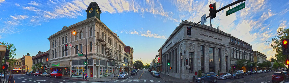
When I was a boy, my great-uncle Will Casey took me on walks around Petaluma, filling my head with local lore. One day we stopped across from the town clock to gaze upon the 1880s cast-iron front buildings lining Western Avenue.
“When I was your age,” Uncle Will said, “I stood here and watched them build those.”
That bit deep.
A retired town merchant, Uncle Will was one of Petaluma’s popular storytellers in his old age. For me, his stories always brought the past alive, giving me a sense of place and continuity. But once I grew older and started researching Petaluma history, I learned his tales weren’t all that factual, which might be what made them so memorable.
“Never let the facts get in the way of a good story,” Mark Twain said, or is reputed to have said.
Mark Twain (photo by A.F. Bradley, public domain)
People often conflate lore with history. But as meaning-making creatures, humans tend to be more interested in meaning than truth, which is where lore and history part ways.
Lore functions much like memory, which, according to playwright Tennessee Williams, “takes a lot of poetic license. It omits some details; others are exaggerated, according to the emotional value of the articles it touches, for memory is predominantly seated in the heart.”[1]
That same dim interior protects lore from cognitive dissonance with contrary facts.
Coalescing around objects, sites, and monuments, lore is passed down from generation to generation as sacred and absolute.[2]History, by contrast, is secular. No one has a monopoly on its narrative. Multiple, conflicting perspectives are part of its truth.
STORYTELLING
Like a detective investigating a cold case, trained historians take a critical and skeptical view of all human motive and action. Vigilant about making mistakes, they question everything, including their sources and their own perspectives, which they struggle to root in the contextual complexities of the times they are investigating.[3]
According to historian David McCullough, history’s attraction is driven by two of life’s most absorbing mysteries—time and human nature.[4]
David McCullough (National Endowment for the Humanities)
Hilary Mantel, prize-winning author of the historical novel Wolf Hall based on the life of Thomas Cromwell, had a similar take. “History is what people are trying to hide from you, not what they’re trying to show you. You search for it in the same way you sift through a landfill: for evidence of what people want to bury.”[5]
That is also where some of the most compelling stories can be found. As the current popularity of genealogy demonstrates, the more you learn, the more you want to know. Thanks to recent advances in digital access, sifting through the landfill is becoming more efficient than ever.
But for the historian, gathering research is merely the first step. As with a composer assembling notes, one ultimately needs to make music. Which is where storytelling comes in.
“You have to be clear and you have to be interesting,” Barbara Tuchman, author of The Guns of August, wrote in her classic essay, “The Historian as Artist.” Her secret: “Tell stories.”[6]
Historian Barbara Tuchman (National Endowment for the Humanities)
Unlike stories of lore, historical narratives are not restricted to sacrosanct scripts owned by groups and communities. Their fundamental plot—the unfolding story of change—tracks with how life itself plays out: ever changing and open to interpretation. What the historian brings to the plot are insights into the consequences of past decisions made and actions taken.[7]
Some offer those insights from a distance, as though chronicling history from a mountaintop. Others, like Tuchman and McCullough, prefer to view it from within, bringing characters from the past back to life in stories. Those stories serve to engage others in a meaningful pursuit of the truth in documenting human nature over time.[8]
Yet, as Oscar Wilde pointed out, “The truth is rarely pure and never simple.”[9] In the marketplace of meaning making, history’s inherent complexity often leaves it victim to the simplified storylines of lore, especially when tailored for commercial purposes.
SONOMA COUNTY SUBSCRIPTION HISTORIES
Nowhere is that more evident than in the early histories of Sonoma County, specifically the seven subscription-based history books published in 1877 (Thompson), 1880 (Munro-Fraser), 1889 (Cassiday), 1898 (Reynolds & Proctor), 1911 (Gregory), 1926 (Tuomey), and 1937 (Finley).[10]
Top, left to right: Robert A. Thompson, J.P. Munro-Fraser; Middle, left to right:Samuel Cassiday, William D. Reynolds, Thomas A. Proctor; Bottom, left to right: Tom Gregory, Honoria Tuomey, Ernest L. Finley(photos credits: Sonoma County Library, Oregonian newspaper, subscription histories)
These books have played a powerful role in sculpting the county’s historical landscape, one that continues to resonate to this day. The early 19th century histories in particular serving as foundations for the histories that folowed.
However, as informative as these books are in many regards, their commercial origins as subscription histories—books pre-sold before publication by door-to-door salespeople—compromise their integrity as official narratives.
Title pages of 1877 and 1898 Sonoma County atlases
Architects of desire, these histories were factory produced and intentionally shaped by what people wanted to hear and experience. Neatly aligning beginnings with ends and causes with effects, they are full of omissions and fabrications created to cover them. Their biographies, illustrations, and historical mentions were customarily paid for by the farmers and business owners they showcased.[11]
Title pages of1880, 1889, 1911, 1926, and 1937 Sonoma County subscription histories
Their underlying ideological purpose was to lend a false inevitability to Sonoma County’s creation and early development as the embodiment of “Manifest Destiny.”
A national propaganda initiative, Manifest Destiny promoted a belief in America’s divine duty to conquer, settle, and prosper in the promised land of the west. Its patriotic call to action appealed to those looking for a brighter future, justifying their break with the familiar and comfortable to plunge into the unknown and make the hazardous journey west, where they dedicated themselves to the hardships of developing farms and towns.[12]
Given that context, the appeal of subscription history books at the time is understandable.
By the late 1870s, settlers to Sonoma County had endured three decades of surprises and uncertainty, including land grant and homesteading legal challenges, agricultural booms and busts, cataclysmic fires and floods, resistant Natives, unwanted immigration, a Civil War, and a national recession. They needed a narrative to affirm it had been worthwhile, one that celebrated them as pioneers in the successful service of Manifest Destiny.
For that reason, the series of manufactured histories of early Sonoma County are best viewed as a study in human meaning making, with a skeptical eye toward historical source material. As such, when taken with a grain of salt, they no longer hinder our ability to look to the county’s past as a means of better understanding its present.
Iron front buildings along Western Avenue, 2026 (photo courtesy of Scott Hess)
******
A version of this story appeared in the Sonoma Historian, Winter 2026 edition
FOOTNOTES:
[1] Tennessee Williams, Stage Directions for Scene 1 of The Glass Menagerie (Oxford: Heinemann Educational Publishers, 1945), page 1.
[2] David Blight, “History and ‘Memory,’” Commonplace, the Journal of Early American Life, Issue 2.3, April 2002.
[3] “Statements on Standards of Professional Conduct,” American Historical Association, January 2023. https://www.historians.org/resource/statement-on-standards-of-professional-conduct/
[9] Oscar Wilde, The Importance of Being Earnest (Dover Thrift Editions, R.R. Donnelley, 2016), p. 6.
[10]T.H. Thompson, Historical Atlas Map of Sonoma County (Oakland, CA: Thos. H. Thompson Company, 1877); J.P. Munro-Fraser, History of Sonoma County (San Francisco, CA: Alley, Bowen & Company, 1880);Samuel Cassiday, An Illustrated History of Sonoma County (Chicago, IL: The Lewis Publishing Company, 1889);Tom Gregory, History of Sonoma County (Los Angeles, CA: Historic Record Company, 1911).
[11]How ‘Tis Done: A Thorough Ventilation of the Numerous Schemes Conducted By Wandering Canvassers Together with the Various Advertising Dodges for the Swindling of the Public (Chicago: Fidelity Publishing Co., 1879); Walter A. Friedman, Birth of a Salesman: The Transformation of Selling in America (Cambridge, MA: Harvard University Press, 2004).
[12] Anders Stephenson, Manifest Destiny: American Expansion and the Empire of Right (NY: Hill & Wang, 1995).
Entrance to the Union Hotel Beer Hall, Main and B streets, c. 1892, with the saloon proprietor John Hermer most likely the man with the white beard (Sonoma County Library)
In 1852, two brothers from Germany, Herman and John Schierhold, purchased a lot at the southwest corner of Main Street and today’s Western Avenue. Using timber they hauled down from Freestone, they built a two-story hotel. A classic German “gasthaus,” it included a bar and billiards room on the bottom floor, with six rooms upstairs for boarders and guests upstairs.[1]
The Schierholds’ gasthaus became an anchor for Petaluma’s growing German merchant district. By the mid-1870s German-owned businesses extended along the west side of lower Main Street from Western Avenue to Center Park (today’s Historic Chinatown Park).
They included Heinrich Matthies’ Continental Hotel and John Pfau’s Centennial Building (today’s Land Mart), which featured a German saloon, a livery stable, Heinrich Dortmund’s Wine Depot, and the German Druids Hall.
German-owned Continental Hotel and beside it the Centennial Building, 1890s (courtesy of Dan Brown Collection)
Two blocks away on Fourth Street between B and C streets sat Turn Verein, or Turner Hall, which served as a German social club, hosting lectures, social events, dances, festivals, and musical performances.[1a]
Turn Verein or Turner Hall at Fourth Street between B and C streets, built 1875 (Petaluma Historical Library & Museum and Petaluma Courier)
In 1855, the Schierholds sold their gasthaus to a woman named Rosanna Loftus who renamed it the Farmers’ Hotel. A married woman, Loftus purchased the hotel as a “sole trader,” which meant she was legally able to own and operate her own business independent of her husband.[2]
1855 map with arrow pointing to site of Farmers Hotel (Sonoma County Library)
Herman Schierhold went on to operate the Relief Saloon and the Capitol Saloon in town, as well as the Petaluma Brewery. The first brewery in Sonoma County, it was originally founded in 1855 by a fellow German immigrant, Fredrick Christlich.[3]
In 1858, a German named August Starke purchased the Farmers’ Hotel from Loftus, renaming it the Union Hotel & Saloon.[4] In 1866, he leased out operation of the hotel and saloon to Heinrich Matthies, who added “Deutsche Gasthaus” to the name Union Hotel.[5]
Illustration of the Union Hotel, Deutsche Gasthaus, 1885 (Map of Petaluma by William W. Elliott, Sonoma County Library)
In 1876, Petaluma’s leading capitalist John McNear purchased the hotel building and property from Starke’s widow, Frances.[6]
In 1881, McNear sold the Union Hotel building to fellow capitalist Isaac Wickersham, who moved it to property he owned at the southeastern corner of Main and B streets. That cleared the way for construction of the Masonic Lodge at the hotel’s original site on the corner of Main and Western Avenue.
Masonic Lodge at Main Street and Western Avenue, 1902 (Petlauma Historical Library & Museum)
Meanwhile, Wickersham undertook a complete rebuilding of the hotel in its new location, adding 17 new rooms.[7]
In 1889, the description “Deutsche Gasthaus” was dropped from ads for the Union Hotel by longtime operator Samuel Carstens, a Danish immigrant A German named John Hermer ran the Union Beer Hall in the hotel.[8]
Ad for Union Hotel Beer Hall, Petlauma Courier, May 24, 1892.
In 1900, a fire, suspected to be arson, badly damaged the hotel, destroying its bar and bowling alley. By that time, the hotel was owned by G.P. McNear, who leased it to Claus Struve, a German immigrant, and Jimmie Rasmussen, a Danish immigrant.[9]The hotel was restored and reopened.
In 1902, G.P. McNear’s Oriental Mills & Feed headquarters on Main Street across from Penry Park (then Hill Plaza) burned down. McNear decided to relocate his operation to the site of the Union Hotel, which sat in front of one of his grain mills (today’s Great Petaluma Mill).
He announced plans to move the Union Hotel to Third streets and C streets so that he could clear the site for his new building. A few months later, he changed his mind, and decided to tear the hotel down instead.[10]
New G.P. McNear Feed Company Building, 1903 (Petaluma Historical Library & Museum)
So ended the legacy of a 50-year old Petaluma landmark building.
FOOTNOTES:
[1] “Local News As Condensed,” Petaluma Argus, October 3, 1902; “Built the Union Hotel,” Petaluma Courier, October 3, 1902; Note: no mention of the name of the Schierholds’ hotel found.
[1a] “Cosmopolitan Hotel,” Petaluma Argus, August 25, 1876; “Pfau’s Centennial Building,” Petaluma Argus, March 3, 1876; “Centennial Headquarters,” Petaluma Argus, July 14, 1876; “The Druids,” Petaluma Courier, December 22, 1880; “Turners’ Ball,” Petaluma Argus, January 1, 1875.
[2] Legal Sole Trader Notice, Petaluma Journal, September 22, 1855; Ad for Farmer’s Hotel, Petaluma Journal, November 20, 1855; Note: not clear if Schierholds were the owners at time of sale to Loftus.
[3] “Courierlets,” Petaluma Courier, October 22, 1884; “H. Schierhold Died Weeks Ago,” Petaluma Argus, December 22, 1905; “Petaluma Breweries,” Petaluma Argus, December 8, 1876; Note: Christlich launched the brewery with a partner named Erbe, who by 1860 had sold out his interest to Christian Theilman, who died in 1864.
[4] Ad, Sonoma County Journal, February 12, 1858: Starke converts Farmer’s Hotel to Lager Beer Saloon; “Brutal,” Sonoma County Journal, February 11, 1859: Starke’s establishment now referred to as the “Union Billiard Saloon”; Ad for Union Hotel, Sonoma County Journal, October 12, 1860.
[5] Ad for Union Hotel, Petaluma Argus, September 6, 1866. Note: by the 1870s, Matthies was also operating the Continental Hotel (“Cosmopolitan Hotel,” Petaluma Argus, August 25, 1876).
[6] “Brevities,” Petaluma Argus, October 20, 1876; “Real Estate Transactions,” Petaluma Argus, November 3, 1876.
[7] “City Improvements,” Petaluma Courier, June 1, 1881; “Housewarming,” Petaluma Argus, August 19, 1881; “Reopened,” Petaluma Courier, August 31, 1881; Ad for Union Hotel, Petaluma Argus, September 30, 1881.
[8] Last ad for Union Hotel including “Deutsche Gasthaus,” Petaluma Courier, January 30, 1889; Ad for Union Beer Hall, Petaluma Courier, May 24, 1892; “John Hirmer Dead,” Petaluma Courier, May 31, 1894.
[9] “The Union Hotel Badly Wrecked,” Petaluma Argus, July 9, 1900.
[10] “A Midnight Blaze,” Petaluma Courier, June 11, 1902; “Union Hotel to Be Moved to Third and C Streets,” Petaluma Argus, August 15, 1902; “Local News As Condensed,” Petaluma Argus, October 3, 1902.
Full county map with illustrations of Sonoma Democrat and Petaluma Argus newspaper offices, Historical Atlas of Sonoma County, 1877
On the evening of May 16, 1876, William Colvig rode his horse to the Washoe House in Stony Point. Having spent the day surveying ranches, he was in need of supper and a room. The next morning he traded his tired horse for a new mount, and set off to survey Harrison Mecham’s nearby 10,000-acre ranch, not knowing Mecham wasn’t at home. Like most of his neighbors, he had left for Petaluma to see Montgomery Queen’s Traveling Circus.[1]
Washoe House, Stony Point & Roblar roads, c. 1900 (Sonoma County Library0
Colvig was part of a different traveling show—Thompson & West, publisher of county atlases. A new, mass-market racket, the county atlas appealed to settlers yearning to celebrate their participation in America’s epic westward movement.[2]
Published in a 15 x 18 inch book format, the typical atlas featured more than 100 pages of hand-colored maps and illustrations.[3] Available only by pre-order from door-to-door canvassers, it was priced as a luxury item at $15 ($460 in today’s currency). Subscribers were asked to pay half down and the rest upon delivery, which was usually a year away.[4]
Historical Atlas of Sonoma County, published by Thos. H. Thompson & Co., 1877 (photo Sonoma County Library)
Thompson & West, or T&W as they were known, looked to sell at least 1,500 copies of the Historical Atlas of Sonoma County, generating $22,500 in revenue ($700,000 in today’s currency).[5] Their main targets were the farmers and ranchers whose names were to be featured on the atlas’ maps, along with the size of their landholdings.
Canvassers preyed upon their egos and sense of social status, assuring them nothing better reflected agrarian progress, personal accomplishment, and civic pride than a luxurious atlas. Designed for display on the parlor table, the atlas was an heirloom families would treasure for generations.[6]
Colvig had worked previously for atlas publishers in the Midwest, where the books gained a reputation for being quickly and carelessly assembled, leaving behind duped customers and a flawed record of local landscapes.[7] Reluctant to rejoin the circuit, but in need of money, he agreed to work as a field surveyor for T&W, on the condition he wouldn’t have to double as a canvasser.[8]
William Colvig, 1873 (courtesy of Tim Colvig)
After discovering Mecham had gone off to the circus, Colvig rode into Petaluma, where he kept a room at the American Hotel (site of today’s Putnam Plaza). Awaiting him at the hotel was a telegram from T&W’s owner, Thomas H. Thompson, summoning him to the company’s office in San Francisco.[9]
American Hotel (center two story building), Main Street, Petaluma, 1869 (Petaluma Historical Library & Museum)
A founder of the county atlas craze, Thompson served in the Union Army as a battle captain and surveyor during the Civil War. After the war, he teamed up with two former army colleagues, Louis H. Everts and Alfred T. Andreas, to revolutionize the mapmaking business. They did so by combining the popular characteristics of the county wall map with illustrations and county histories in a book format.[10]
Captain Thomas Hinkley Thompson, Union Army, 1860s (public domain)
The three began publishing county atlases in Iowa and Illinois. In addition to ordering copies, subscribers also could purchase a full-page illustration of their farm or business for $145 ($4,400 in today’s currency), a hand-drawn portrait for $100 ($3,000 today), and a biography at two and half cents a word ($1 today).[11]
Farm illustrations included any improvements a farmer envisioned, and omitted anything he didn’t wish to show.
Illustration of atlas artist from Bates Harrington’s 1879 book How ‘Tis Done
Likewise, subscribers were given the final review of their biographies. Local merchants who endorsed the atlas received free listings in the book’s “business directory.” Newspapers willing to provide free publicity were rewarded with illustrations of their offices in the atlas.[12]
Illustration of Harrison Mecham’s ranch, Sonoma County Atlas, 1877
In 1875, Thompson brought his “maps for the masses” craze to California, teaming up with Albert A. West to launch Thompson & West Publishing. Thompson handled the mapping and production, West the histories and biographies.[13]
Albert A.West & Thomas H. Thompson, 1870s (Sacramento Bee)
The two began peddling atlases in Santa Clara, Solano, and Alameda counties. In 1876, they added Sonoma County to the mix. To round out their 12-man crew of canvassers, artists, surveyors, and writers, Thompson reached out to Colvig, who, after working with Thompson in the Midwest, had returned home to Oregon.[14]
Trained as a mapmaker in the Union Army, Colvig was assigned by Thompson to verify and update official surveys of Sonoma County. That included the county’s first comprehensive wall map, created in 1866 by A.B. Bowers.[15] Traveling by horse, Colvig reviewed property lines and mapped out significant topographical features, along with churches, schools, mills, roads, and railroads.[16]
Colvig’s sketch of Harrison Mecham’s property near the Washoe House (courtesy of Tim Colvig)
Known for his people skills, Colvig paid ranchers $1 a night ($30 in today’s currency) for supper and lodging. That led to some strange encounters, including the night he spent at the ranch of Dr. J.H. Happy, a spiritualist, whose young son attempted to induce him into a trance by playing a violin made from an old cigar box.[17]
Colvig accompanied Thompson to Santa Rosa to successfully lobby the county Board of Supervisors to adopt the atlas as the county’s official map.[18]They also appealed for free publicity from the publisher of the Sonoma Democrat newspaper, Thomas L. Thompson (no relation to T&W’s Thomas H. Thompson).[19]
Thomas Larkin Thompson, proprietor and co-editor of the Sonoma Democrat newspaper(public domain)
He informed them that his brother Bob—Robert Augustus Thompson, Jr., who co-edited the newspaper, had already written a 24,000-word history of Sonoma County the Sonoma Democrat had published the year before.[20]
A positive, reaffirming narrative, Bob’s history sidestepped or downplayed any political, economic, and social divisions in the county’s 26-year old history. Instead, he provided descriptions of the county’s climate, geography, topography, agriculture, and timber. There were also sketches of its milling, mining, and wine interests, and brief histories of each town .
Bob Thompson’s “A Brief Historical Sketch” of Sonoma County, Sonoma Democrat, January 2, 1875
Bob’s format and approach was the same T&W used in their county atlases, indicating he might have anticipated their arrival. To gain the Sonoma Democrat’s support, T&W agreed to license an expanded version of Bob’s history for the atlas, and allow Bob to publish it independently. Bob’s motives for doing so were likely political.[21]
Robert A. “Bob” Thompson (Honoria Tuomey, History of Sonoma County, 1926, p.207)
A leader of the Sonoma County Democratic Party, he was planning to run for county clerk in 1877. Authoring the county’s first comprehensive history would not only burnish his credentials, but also make for good publicity.[22]
In August 1877, The Historical Atlas of Sonoma County was delivered to subscribers under the imprint “Thos. H. Thompson & Co.,” presumably because Thompson’s partner West was not involved with the history section.[23]
Title page of the Historical Atlas Map of Sonoma County, 1877
The book contained 12 colored maps; 15 town and village plats; 120 engraved illustrations of farms, businesses, and buildings; Bob’s history; and five commissioned biographies and portraits of prominent settlers.
The book was met with great acclaim, at least from T&W’s local promoters. Many acknowledged that while it got some details wrong, on the whole it was the most complete effort to date.[24]
There were, however, disappointed subscribers who refused to pay for the balance of their orders. After T&W sued them for payment, a handful countersued, claiming their signatures on the orders had been forged.[25]
Illustration of a canvasser from Bates Harrington’s 1879 book, How ‘Tis Done
Colvig left Sonoma County long before the publication date. Having grown increasingly frustrated with the sketchiness of official surveys in the county’s western region, he returned early to Oregon. Pursuing a new career in the field of law, he was eventually elected district attorney of a district encompassing Jackson, Josephine, Lake, and Klamath counties.[26]
Judge William Colvig, Oregon, early 1900s (photo courtesy of Tim Colvig)
Coinciding with the atlas’ release, Bob became the Democratic Party’s nominee for Sonoma County clerk. He also published his own pamphlet version of the atlas’s history—A Historical and Descriptive Sketch of Sonoma County, for sale in bookstores for $1 ($30 in today’s currency). Shortly after, he was elected to the first of three terms as county clerk. His legacy today is as Sonoma County’s first historian.[27]
Robert A. Thompson’s Historical and Descriptive Sketch of Sonoma County, 1877
While T&W’s atlas provided a sense of stability to Sonoma County residents, its landscape images projecting a spatial permanency rooted in social values of family, community, and commerce, the ephemeral nature of the county atlas itself suggested such stability to be precarious.[28]
By the late 1870s, the novelty of “maps for the masses” began to lose its appeal. Subscription publishers like T&W quickly transitioned to a new model known as the “mug book.” Gone were the maps and illustrations, replaced by commissioned biographies with engraved portraits of their subjects, hence the nickname “mug book.”[29]
Sonoma County’s first mug book, History of Sonoma County, made its appearance in 1880.[30] Written by J.P. Munro-Fraser, it provided a more robust and colorful history than that of the 1877 atlas. However, the book’s main attraction was its 349 commissioned biographies and 67 engraved portraits, comprising more than 300 of its 745 pages.
Title page of the mug book History of Sonoma County, 1880
Written in the laudatory style of a newspaper obituary, the biographies provided valuable information for future genealogists, but were, for historians, riddled with factual errors and errors of omission.
For better or worse, the mug book became the template of the four subsequent Sonoma County histories that followed, three of them written by local newspaper editors—Samuel Cassiday (1889), Tom Gregory (1911), and Ernest Finley (1937) —and one by Bodega school teacher Honoria Tuomey (1926).
The vanity of their attraction meant that for the next half century, the county was periodically flooded with canvassers knocking on doors with offers to publish the resident’s story and portrait in exchange for a fee and a subscription to the county’s new, exciting history.
A version of this story appeared in the Petaluma Argus-Courier on February 20, 2026.Special thanks to Tim Colvig for sharing family documents and photos.
******
FOOTNOTES:
[1] William M. Colvig, “Journal for 1876: May 16, 1876,” courtesy of Tim Colvig, Wm. M. Colvig Collection; Ad for Montgomery Queen Circus, Petaluma Argus, May 5, 1876; Mecham acreage cited in Historical Atlas Map of Sonoma County (Thompson & West, 1877), p. 99.
[2] Michael P. Conzen, “The County Landownership Map in America: Its Commercial Development and Social Transformation 1814-1939,” Imago Mundi, Vol. 36 (1984), p. 29
[3] Cheryl Lyon-Jenness, “Picturing Progress: Assessing the Nineteenth-Century Atlas-Map Bonanza,” Michigan Historical Review, Vol. 30, No. 2, Fall 2004), pp. 194, 198.
[4] Walter A. Friedman, Birth of a Salesman: The Transformation of Selling in America (Cambridge, MA: Harvard University Press, 2004), pps. 37-39; Cheryl Lyon-Jenness, p. 169; Note on pricing: Cheryl Lyon-Jenness notes atlas books in Michigan in the early 1870s were priced at $9 a copy. In 1876, Sonoma County’s Board of Supervisors approved the purchase of 15 copies of the Sonoma County atlas for $225, or $15 each. They approved an additional acquisition of one copy in 1877 for $15 (“Board of Supervisors,” Sonoma Democrat, March 11, 1876; “Board of Supervisors,” Petaluma Argus, September 21, 1877; “Where the Money Goes,” PetalumaArgus, November 16, 1877). The Alameda County atlas, published by Thompson & West in 1878, sold for $20, but at 170 pages, was 66 pages longer than the Sonoma County atlas (“A County Atlas Map,” Oakland Daily Transcript, February 25, 1877).
[5] “A County Atlas Map,” Oakland Daily Transcript, February 25, 1877; Conzen, Agricultural History, p. 119. Note: Conzen cites the sales goal was generally 1,000 copies, but the Oakland Daily Transcript estimates the number at 1,500.
[6] Michael P. Conzen, “Landownership Maps and County Atlases,” Agricultural History, Vol. 58, No. 2 (April, 1984), p. 119; “Minnesota Atlas,” Freeborn County Standard, Minnesota, April 30, 1874; Bates Harrington, How ‘Tis Done: A Thorough Ventilation of the Numerous Schemes Conducted By Wandering Canvassers Together with the Various Advertising Dodges for the Swindling of the Public (Chicago: Fidelity Publishing Co., 1879), pp. 22, 27; Cheryl Lyon-Jenness, pp. 194, 198.
[7] “Minnesota Atlas,” Freeborn County Standard, Minnesota, April 30, 1874; Harrington, pps. 42-43, 79-80, 87-88.
[8] Colvig Journal, April 23, 1876. Note: T&W agreed to pay him $100 per month ($3,000 in today’s currency) plus expenses.
[9] Colvig Journal, May 18-22, 1876. Note: in 1877, T&W moved their offices to Oakland.
[11] Cheryl Lyon-Jenness, p. 198; Conzen, Agricultural History, p.119.
[12] Harrington, p. 40; Cheryl Lyon-Jenness, pp. 180, 196, 198.
[13] David F. Myrick, Introduction to the 1958 Reprinted Edition of Thompson & West’s History of Nevada, 1881 (Howell-North, Berkeley, CA, 1958), p. h; Cheryl Lyon-Jenness, p. 168.
[14] “Minnesota Atlas,” Freeborn County Standard, Minnesota, April 30, 1874; “County News,” Vallejo Chronicle, September 29, 1876; “Proposed New Maps,” Oakland Tribune, January 25, 1877.
[15] Charles Sweet, “The Judge Colvig Story,” Table Rock Sentinel, Southern Oregon Historical Society newsletter, September 1986; “Bowers Map of Sonoma County,” Petaluma Argus, December 13, 1866; William Walsh, “The Story of an Inventor,” Overland Monthly, January-June, 1897, pp. 166-179; Cheryl Lyon-Jenness, p. 182; Colvig Journal, April 23, 1876; Note: Colvig reviewed property lines and mapped out significant topographical features, along with churches, schools, mills, roads, and railroads.
[16] Colvig Journal, April 23, 1876; Cheryl Lyon-Jenness, p. 182.
[17] “A Friendly Call,” Petaluma Argus, November 6, 1874; Colvig Journal, April 23, May 3, July 14, August 14, 1876. Note: Colvig ended up working on the atlas for four and a half months, from May 3rd to August 14th.
[18] Harrington, p. 32; “New Advertisements: To the Citizens of Sonoma County,” Petaluma Argus, February 18, 1876; “Sonoma County Atlas,” Petaluma Argus, May 11, 1877; “Card from T.H. Thompson,” Petaluma Courier, August 16, 1877; Note: the Sonoma County Board of Supervisors agreed to purchase 15 copies of the atlas for $225, or $15 each (“Board of Supervisors,” Sonoma Democrat, March 11, 1876; “Board of Supervisors,” Petaluma Argus, September 21, 1877).
[19] Note: Thomas L. Thompson was commonly referred to in newspaper articles of the time as “Tom.” Likewise, Robert A. Thompson went by “Bob” (“Nine Men Have Had Part in Building P.D. in the Last 71 Yrs.,” Santa Rosa Press Democrat, October 28, 1928).
[20] ”The County of Sonoma: A Brief Historical Sketch,” Sonoma Democrat, January 2, 1875.
[21] “Nailed to the Counter,” Sonoma Democrat, June 19, 1877; “A Kindly Recommendation,” Sonoma Democrat, June 19, 1877; “Sonoma County,” Petaluma Argus, September 21, 1877; “Now Ready,” Petaluma Courier, October 4, 1877.
[23] “Thompson’s Sonoma Atlas,” Petaluma Courier, August 16, 1877; Historical Atlas of Sonoma County (Oakland, CA: Thompson & Co., 1877), p. 3; Note: Thompson & West published 14 county atlases and histories between 1876 and 1884, after which their partnership was dissolved, and Thompson moved to Tulare, where he became a real estate broker; the imprint Thompson & Co. published three historical atlas map books on its own—Sonoma County (1877) while Thompson was still in partnership with West, and Fresno County (1891) and Tulare County (1892) after their partnership ended (Introduction to the 1958 Edition of Thompson & West’s History of Nevada, 1881 (Howell-North, Berkeley, CA, 1958, p. I).
[24] “Board of Supervisors,” Oakland Daily Times, January 29, 1878. Note: Facing criticism for their county atlas, officials in Alameda County issued a statement acknowledging the atlas was not entirely correct in some of its details, but was more complete than any previous map.
[25]“Thompson’s Sonoma Atlas,” Petaluma Courier, August 16, 1877; “Card from T.H. Thompson,” Petaluma Courier, August 16, 1877; “The Forgery Case,” Sonoma Democrat, December 1, 1877; “County News,” Vallejo Evening Chronicle, December 7, 1877; “The Atlas Suits,” Oakland Tribune, November 15, 1878.
[26] Colvig Journal, June 14, June 23-24, August 14-16, 1876; “Autobiography of Wm. M. Colvig, 1928,” Oregon Pioneer Association, courtesy of Tim Colvig.
[27] “Proceedings of the Convention,” Petaluma Courier, July 18, 1877; “Sonoma County,” Petaluma Argus, September 21, 1877; Note: R.A. Thompson’s pamphlet, Historical and Descriptive Sketch of Sonoma County (Philadelphia: L.H. Everts, 1877), was published by Thomas H. Thompson’s former atlas partner in Illinois, implying that T.H. Thompson might have arranged for its publication.
[29] Cheryl Lyon-Jenness, p. 208; Rhonda Frevert, “Mug Books,” Commonplace: Journal of Early American Life, Issue 3.1, October 2002, https://commonplace.online/article/mug-books/
[30] “The History of Sonoma County,” Petaluma Courier, February 3, 1880; J.P. Munro-Fraser, History of Sonoma County (San Francisco, CA: Alley, Bowen & Co., 1880).
770 B Street, designed and built by A. M Seeberg in 1929 (photo John Sheehy)
The Mediterranean Revival Style home at the corner of B and Spring Streets was built in 1929 by A.M. Seeberg for Catterina Carpella Berri.
Catterina was born in 1868 in Ticino, Switzerland, to Giuseppe and Grace Bedolla Carpella. As a young girl, she immigrated to California to join her older sister Severina, who had married a Swiss-Italian dairy rancher in Olema named Stephano Toroni. A second sister, Modesta, also immigrated to California, marrying Joseph Silacci of Salinas. Catterina’s brother, Joseph Carpella, remained behind in Switzerland.
Catterina Carpella, circa 1894-1898 (courtesy of Dan Brown Collection)
Catterina lived in Olema with the Toroni family until her marriage in 1898 to Bartolomeo Berri. A 46-year old, Swiss-Italian immigrant, Berri was partners with his brother Vittore (Victor) in the Berri Bros. Dairy Ranch at Salmon Creek near Marshall in Marin County.
Batholomew and Catterina Berri, c. 1900 Bartholomew, Victor, and Catterina Berri, c. 1900 (Dan Brown Collection)
Catterina and Bartolomeo resided on the Berri Ranch, one of the largest in West Marin, until Bartolomeo retired in 1907, at which time they moved to Petaluma, purchasing a house at 816 B Street. Bartolomeo died in 1918, leaving Catterina a small fortune of $75,000 ($1.6 million in today’s currency).
The couple did not have any children. After Bartolomeo’s death, Catterina’s niece and nephew, Sara and Stephen Toroni, came to live with her following the death of their mother, Catterina’s sister Severina.
In 1929, Catterina purchased an empty lot on the corner of B and Spring streets from Charles Lynch, whose family had owned the property since 1875. She then hired A. Mariam Seeberg, a popular Norwegian architect and contractor in Petaluma, to build a new home for her and her niece and nephew.
The chimney at 770 B Street still displays the letter “B” for Berri(photo John Sheehy)
Seeberg, who had designed and built a number of residential and commercial buildings in town, designed Catterina’s new house in the Mediterranean Revival Style popular among his Swiss-Italian clients.
Acclaimed at the time as one most elegant homes in town, it became a signature building for Seeberg, along with his design of Charles Garzoli’s house on Old Redwood Highway in Penngrove.
The Charles Garzoli house designed and built by A.M. Seeberg in 1933 (photo John Sheehy)
A avid gardener, Catterina took great pride in her prize-winning flower beds, which she planted with seeds imported from Europe. She died at her home on B Street in 1937, attended by her niece and nephew, Sara and Stephen Toroni, who continued to reside at the house for the next couple decades.
******
SOURCES:
“Married in San Francisco,” Petaluma Courier, June 8, 1898.
“Marriage Licenses,” San Francisco Examiner, June 5, 1898.
“Mrs. Toroni Died in Olema,” Petaluma Courier, May 25, 1912.
“B. Berri is Summoned,” Petaluma Courier, June 12, 1918.
“Left Big Estate to His Widow,” Geyserville Gazette, July 5, 1918.
“Purple and Pink, Blue and Gold, Flower Show Story in Short is Told,” Petaluma Courier, May 1, 1927.
“A.M. Seeberg Will Build New Building for Hunt & Behrens,” Petaluma Argus, July 27, 1927.
“Mrs. B. Berri Will Build Costly Home,” Petaluma Argus-Courier, July 5, 1929.
“Gorgeous Flower from Berri Gardens,” Petaluma Argus-Courier, June 1, 1933
“Funeral Notices,” Petaluma Argus-Courier, July 6, 1937.
“A. Mariam Seeberg, Long Prominent Here, Succumbs,” Petaluma Argus-Courier, August 9, 1946.
A Video Presentation on the Historical Prequel to the Lafferty Ranch Battle
For nearly the past 200 years, since European contact, neighbors on Sonoma Mountain have battled each other in the courts over legal challenges to deeds, property boundaries, water rights, livestock, and trespassing. Occasionally, those quarrels battles have lead to physical threats and altercations.
No feud has been as long standing as the one being still be waged over public access to Lafferty Ranch, which has been owned by the City of Petaluma since 1959 as part of the city’s water works. In 1992, the the city announced plans make Lafferty into a public park, kicking off the series of lawsuits filed by neighbors over the past three decades.
While feuds may appear to come with the territory, it wasn’t always like that. It arrived with the European and American settlers, and their self-centered entitlement of “I have rights.”